September 7, a friend and I set out from Petawawa on a weekend kayak camping trip up the Ottawa River, our destination Oiseau Rock and perhaps Deep River depending on weather conditions which were not looking at all promising. I had paddled the area before but had little time for exploration on the previous trip and this was the first time for my paddling companion so we were determined to make a go of it despite unfavourable weather predictions.

Petawawa Point
Weather was pleasant as we put in at Petawawa Point following the channel markers to reach deep water and avoiding the many shoals among the islands off Petawawa.


Light on Deep R. Islet

Looking south from Deep R. islet
On arrival at Pt. a L'Oiseau we set up camp, I decided to opt for some shelter as the Saturday forecast was for 20km wind and rain. We moved a picnic table to higher ground that we might set up some tarps.

My tent & our sheltered table
As the day was still nice we decided to take the hike to the top of Oiseau rock while the ground was still dry fearing Saturday's weather might make the trail too treacherous.

trail up Oiseau Rock

Are we almost there?
Reaching the summit one is rewarded with a view that makes all that effort worthwhile, looking to left of image you can see Oiseau Pt. reaching out into the river, our camp being on the other side so hopefully protected from the NW winds expected Saturday.
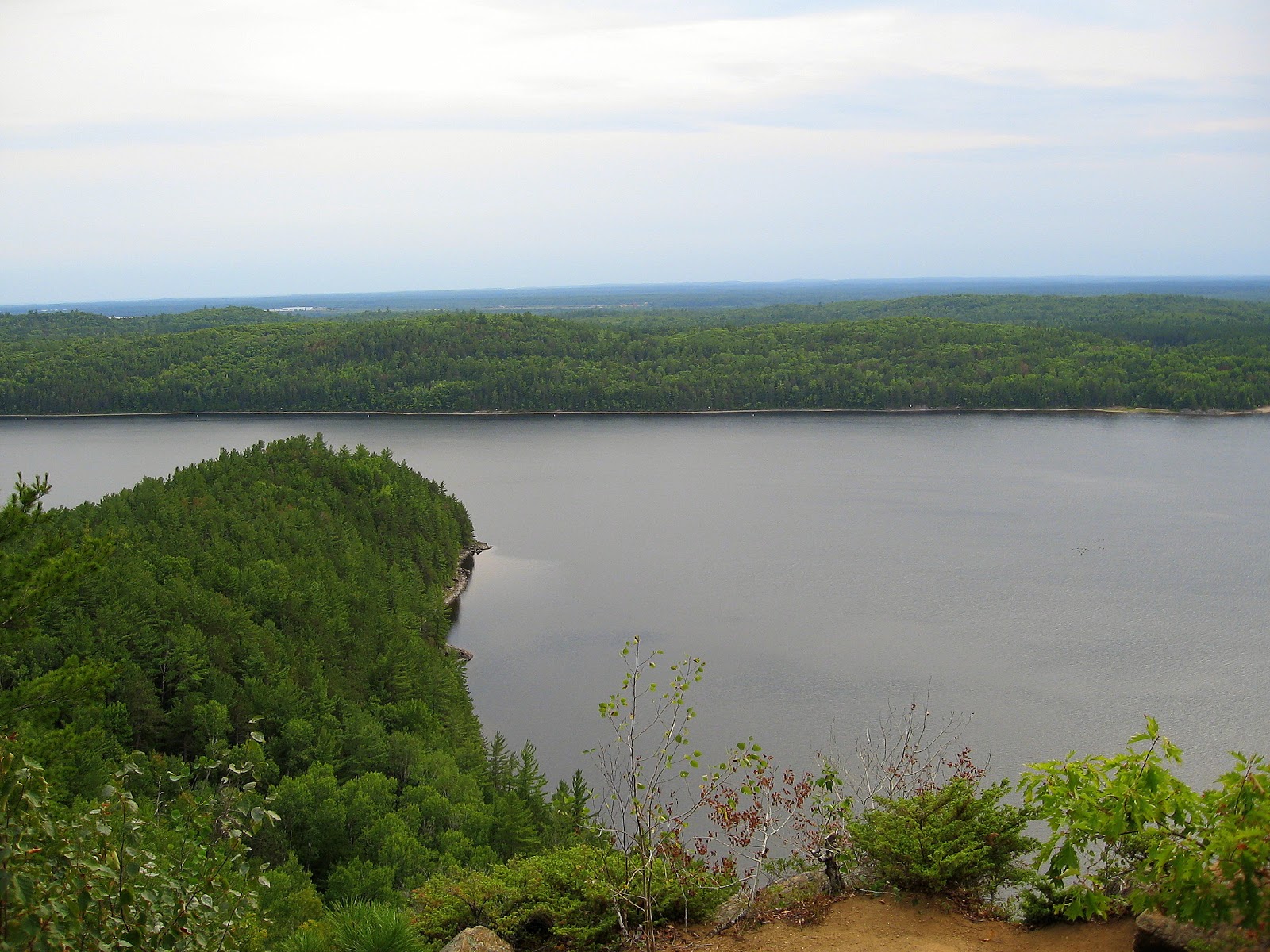
Looking west

Looking NW or up river
From the lookout a short trail <100m runs NE to a tarn on top of the rock where there is a picnic table, where if you had the foresight to pack a lunch one could sit and enjoy a meal.

Tarn atop Oiseau Rock
The winds began during the night and Saturday dawned wet and blustery, wind although blowing down river, yet strong enough to eddy back into the bay to rattle our tents and shelter; not a day for paddling.

When it lets up somewhat in the afternoon we hike the lower trail to the lookout facing the cliff. On examining the cliff face through binoculars I am greatly disappointed to see the extent of graffiti defacing the natural beauty of this timeless landmark and all but obliterating, or at least rendering them indistinguishable, the pictographs placed there by native peoples. The interpretative sign tries but fails to guide the viewer past the etchings of imbeciles to the placement of the pictographs. It almost seems as if some tried their best to obscure them by using a red paint similiar in pigment to that used by the native people.

Oiseau Rock from lower lookout

Graffiti
I think, that in my ideal world, that somehow by removing these mindless scrawls magically by the same act we could erase Sharon, Blayne, Scott, Rick and others of their ilk from the gene pool thereby safeguarding this heritage for future generations to enjoy. Hah...if only!

Rainbow after the rain
Around 6:30p.m. skies clear again and we are presented with a rainbow which seems to indicate the pot of gold might only be a couple of kilometers offshore, hmm..
Sunday is a decent day, mostly cloudy with about 10k wind from NW so we will have a tail wind on our return journey. We paddle round to get a close up of the cliff face from the water and the solitary chimney like rock created by glacial forces before turning about and heading downstream towards Petawawa.

150m/492'

Rock tower
We retrace our route back to Petawawa Point arriving at the beach around 4p.m. feeling satisfied that we had made the most of a less than ideal weather weekend and are a little more knowledgeable about the area.
