Thursday 15 October 2020

Grenadier - Fall Colour

 Grenadier Island


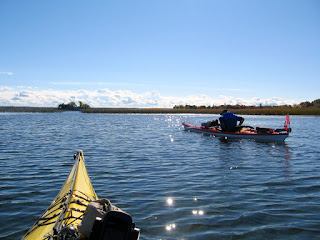
Finally a perfect day to paddle and enjoy the beautiful Fall colours after several days of high winds and intermittent rain.  So ideal for a circum-navigation of Grenadier Island and being a weekday not likely to be much boat traffic to interfere with our enjoyment of the peaceful surroundings.   Arriving at the Parks Canada Mallorytown Landing boat ramp we are happy to find that we can park for free as the self serve machine has been taped up and is not in service, an added bonus!
Beach- Mallorytown Landing

Three of us today and we launch from the beach behind the visitor centre rather than use ramp thereby avoiding any boaters with trailers etc.  From the beach we head SE for an open water crossing of just over 2 km to reach the marsh at the NE end of Grenadier.  This is a rather pretty area where you might find Mute swans, ducks and the occasional marsh bird like Pied-billed grebe.  It is also fun to paddle through the marsh grass.


There are two distinct channels through the marsh, we take the right one which will angle over towards the bay leading to Grenadier East, one of several camping areas on the island.  Rounding the NE corner of Grenadier we will now travel SW along the outer shores of the island as we head to Grenadier Central the largest camping area where there is a beach and we can stop for a lunch break.


On this side of the island you are but a short distance from the international border and the shipping channel which lies just within U.S. waters.  About 1/3 of the way to our lunch stop we pass Sister island with it's lighthouse which almost straddles the Canada/U.S. border but actually is on the U.S. side.  Also of interest in this area is a wreck site in the bay west of Sister island, in calm water and the right light some of the long timbers can be seen from the kayak.  It used to be marked by a plastic bottle float which seems to have since disappeared.

Position approximate

Just after passing Sister island we get a good view of a vessel as it heads downstream, an oil/chemical tanker the Atlantic Spirit destined for the Netherlands.

Atlantic Spirit

Approaching Grenadier Central we are treated to a blaze of Fall colours and tranquill waters as we paddle in toward the beach to take out and have lunch.


Grenadier Central

In the summer this bay gets quite busy as many boaters choose to anchor here as being very shallow it is a great spot for swimming, but today thankfully we have it all to ourselves.


After lunch we continue with our SW travel until we round the end of Grenadier  through the channel past Little Grenadier and Buck islands before turning NE to once again follow the shoreline of Grenadier going back towards Mallorytown.   At this point to the west we can see the Ivy Lea international bridge and off in the SSW we can just discern the rooftops of Boldt Castle above the treeline.

Ivy Lea Bridge

In this channel we pass the docks of Grenadier West which has docking facilities but no camping just day use.  

Private property near Grenadier west

We will continue this course until reaching Squaw island which is separated from Grenadier by a grassy marsh which although very shallow can be navigated by a kayak.  Just before this is a large wheel in the water, not really sure what it is but it makes for an interesting photo.

Mystery wheel

Just shortly after passing Squaw island we set a new course northward which will bring us back to Mallorytown Landing to end our paddle.

Heading north to Mallorytown Landing


Happy paddling!
from
KayakJock


Monday 14 September 2020

Chimney Island - Singer Castle - Adelaide Island

Military History & Murder Mystery

Chimney Island

Chimney Island

 For today's paddle I plan to look at a couple of local historic sites as well as a modern castle.  I will be launching from a spot off the 1000 Island Parkway very close to my first stop enroute,  The put-in is a bit muddy especially with lower water level and is almost totally hidden by shore growth of reeds so one might need to rely on their gondoleer skills to reach sufficient paddling depth.

Heading for open water

Chimney island also known as Bridge island was instrumental in protecting our supply route, the St. Lawrence river during the war of 1812 with the Americans.  The British having built a fortified blockhouse in 1814 armed with an 18 pounder canon.   The island provided shelter for supply boats and gunboats also mustered there.    Today the island is privately owned and the prominent chimney is modern, the original having long disappeared.   The island also had a gory history prior to its militarisation in the story of a wealthy frenchman who lived there with his beautiful aboriginal wife.  This couple were known for their generosity, providing refreshments to travellers on the river. Then one day the frenchman was found murdered in his canoe but no sign of his beautiful wife who was never seen again.   There could be several interpretations but one notes that even today indigenous women are frequently victims of crime, disappearing and sometimes found murdered.


Chimney Island
    

Dark Isle & Singer Castle

Leaving Chimney island behind I head east then SE for my next location Singer Castle on Dark Isle.  I do this by hopping between some small islets, basically big rocks, roosts to 100's of Cormorants and covered in droppings which can be detected at some distance.  This way I have roughly 1km open water between islets rather than make one long open water crossing.  First up is Griswold then Gull before reaching Dark isle.

Griswold Island

Singer Castle built in 1905 by Frederick Bourne, 5th president of Singer Sewing machines inspired by a novel of Sir Walter Scott's. This at a time another famous castle was being built up river:Boldt Castle.   As one approaches from the Canadian side your first view is of the massive boathouse where millionaires can keep their luxury yachts and in Bourne's case a steam powered vessel.  Bourne was an aficionado of fast cars and boats and today some of his boats can be seen at a museum in Clayton N.Y.

Boathouse

As I paddle around to the front I can now fully appreciate the architecture of this elegant structure with its turrets and crenellations.    Like all good castles this one was designed with secret passageways and even a dungeon.  Apparently the passageways were so that "the help" could move around catering to the owners and guests without actually being visible.  Perhaps the dungeon was for those who contravened the rules?😏

Castle east facade

This castle is very different from Boldt castle which I have toured and is probably worth a visit someday post pandemic but having seen what I can from the water and having no invitations from Rapunzel this prince is getting back to Canadian waters "tout de suite" as they say in Quebec having no wish to encounter U.S. border patrol again.

No Rapunzel😢

Adelaide Island

From Singer I head SW for approx 1.5km to Reach Grape island then S just over 1/2km to the start of an archipelago that runs NE from Grenadier island.   Now I follow this string of islands to my next destination Adelaide island one of the 1000 Islands National Park islands.    Passing between Peel and Robert islands I spot a group of 5 common Mergansers all female, likely in migration.  

Common Mergansers

Between Peel & Robert Is.

This is one park island I have never visited and my decision to visit was made when I learned the picnic shelter on it is designated as a historical place.   Its design reflecting an aesthetic developed by the National Park system in the 1920's when the 1000 Island National Park was created to open up wilderness areas for the enjoyment of Canadians and tourism.   First off I notice there is no docking which I know was there in past years and no boats anchored at mooring buoys still extant.   I find a narrow gravel beach beneath a tree that allows me to get the kayak half out of the water and scramble up to higher ground with my chair and lunch.   Settling down to eat by the self-serve payment box it looks like the island may be temporarily withdrawn from service, no forms in the box and everything looking a bit overgrown.   I suspect the dock was likely damaged or destroyed either 2017 or 2019 the years of high water and severe flooding in the 1000 islands.

View from my perch

I sit on my folding chair having lunch overlooking where I believe the dock once was, the picnic shelter is still there as is some picnic tables and a toilet.

Adelaide picnic shelter
View toward Grenadier East

With lunch over I'm back in the boat and heading home taking the channel through the marsh at the SW shore of Adelaide and then directly across river towards Mallorytown Landing where I'll turn NE and follow the shoreline back to my put-in opposite Chimney Island.   As I paddle through the channel I see a gap in the reeds leading to an area enclosed by reeds, so I quietly sneak in hoping to surprise some wildlife.   Sure enough I spot a Pied-billed grebe before he spots me.  Often hard to see as once they get wind of you they dive and being excellent swimmers will only resurface somewhere out of sight.

East Grenadier marsh

It was another perfect paddling day on the St. Lawrence, till next time.


Happy paddling!
KayakJock


Click images to view larger.


Saturday 6 June 2020

St. Lawrence kayak paddle

Brockville to Prescott

Note: click on images for larger view.

Friday June 5th and it is a lovely sunny day with a bit of a breeze from the SW so ideal conditions for a paddle I have been meaning to do for sometime as it will complete my paddling experience of the St. Lawrence from Kingston to Prescott.  It is not the most interesting section of the river as the 1000 Islands with their beautiful settings and properties really begin and extend westward from Brockville, whereas this section is devoid of islands.

As this trip is almost 20 km I am getting dropped off at the Henry St. ramp in Brockville and will phone for pick up on arrival in Prescott.

Henry St. ramp

Just one young lady with her rec kayak and when she pushes off I have the ramp to myself, no pushy boaters to contend with;great!  By about 11:10 i'm off and paddling along the Brockville waterfront, past the Tall Ships condo then a nice panorama of the Brockville skyline and downtown.

Tall Ships
Downtown Brockville


There actually are three small islands mid-stream called the 3 Sisters, not that you would want to visit them as they are home to roosting Cormorants which leaves them stinking and desolate.   The Canadian shoreline is quite built up with many waterfront properties so it does not offer much in places to land, its either private or not suitable due to topography and when scanning google aerial photography I was unable to determine anything suitable for a lunch stop.  So I will be keeping a sharp lookout for something suitable as I get near my mid-way point.


Nice property
Of course one thing you are likely to see here is the seaway traffic, which although not close enough to be a bother does provide some photo ops.


I thought I might find somewhere to stop at Maitland a small community about 7 km east of Brockville but no luck.  Being hungry I was getting a bit anxious as I didn't feel like going the whole distance without eating but just after the 10k mark I spot what appears to be a road coming downhill through the trees to the water.  Not knowing if this be private I head over to investigate and lo and behold it seems to be a ramp but with traffic cones at the top barring entrance.

Ramp closed

Perfect for lunch

Up the hill to check out the signs; closed for construction and Covid 19 warnings so just perfect, nobody going to be driving down while I have lunch. If I didn't want to go further this would also be perfect for my pick up as it is just off highway 2.   Lunch over and a pit stop, I am much refreshed and ready to continue my route to Prescott.   Turning back into the river I can now see the bridge to the U.S. in the distance.
Social distancing at its best?
Still a good breeze but perhaps veered a bit to the south and I am making good time.  I can see Ogdensburg on the U.S. shore and now can make out a ship parked at the Canadian Coast Guard station in Prescott.
Ogdensburg N.Y.

Prescott Coast Guard

If you look closely at the pic above midway between the ship and the bridge you can just discern the red roof of the windmill of "Battle of the Windmill" fame, the last attempt by the U.S. to invade Canada November 1838.  Prescott is also known as the fort town home to Fort Wellington built 1813-14 and around 1830 garrisoned by a detachment of the 79th reg. of foot my GG-grandfather's outfit when he was stationed at Fort Henry in Kingston.  So clear sailing for me into Prescott and I arrive at 15:00.   There is a decent ramp and parking area right at the west end of Prescott but I plan to use the small beach a little farther east as I can easily slide the kayak onto the sand and unload.  The beach being closed due to the current pandemic restrictions I wont be disrupting any bathers.

Prescott boat ramp

Prescott beach

After a quick call to home to set my ride in motion I start packing up.  A fellow comes down the beach and asks if he can give me a hand bring the boat up.  He was a one time kayaker but now with a young family he has let it slide.   I take him up on the offer and we get the yak up onto the grass verge where the wife can park and she will be happy being spared the additional carry.  So ends another nice day on the water.


Happy paddling
from
KayakJock


Friday 22 May 2020

St. Lawrence - Jones Creek

Browns Bay to Jones Creek


Jones Creek & Mud Creek

Today I am going to explore Mud Creek a tributary of Jones Creek having paddled Jones before, going up as far as the 401 highway which crosses at a point roughly where navigation ends.    It is a glorious day, the beginning of a warm spell that promises to last all week and for once there is little wind which makes a nice change.    I'm launching at the boat ramp by Brown's Bay and will then head NE along the west shore of the St. Lawrence river for about 2.5 km to reach the entrance to Jones Creek.

Boat launch


Dark Isle

Looking SE from the launch one can see Dark Isle at about 3 km distance, home to Singer Castle.   There is a very impressive property one passes as you reach the small bay leading to Jones Creek, the bay itself is fronted by a string of small islands.  The largest; Princess island I have used several times as a lunch stop on longer trips, being uninhabited and having a little shallow lagoon that is ideal for parking the kayak while getting out for lunch.

Nice home
Guests?


Jones Creek entrance

Entering the creek you pass beneath the new bridge on the 1000 Islands parkway completed last year.   The creek falls in property owned by Parks of the St. Lawrence and includes hiking trails as well as the Skywood adventure park with zip lines.    

Jones Creek

After travelling two kilometers on Jones I come to the entrance for Mud creek and turn  left.   I have done some walking of these trails earlier this spring and both the wife and I sustained tick bites for our trouble.  The one I got had the tell-tale bullseye necessitating a visit to the emergency room to get the necessary to prevent Lyme disease.   I have been informed that this is a bad year for them so be warned.  I see movement on the bank and paddle over to investigate.

Busy Beaver
Just a beaver who doesn't seem too perturbed at my presence allowing me close enough to capture an image before slipping quietly away.  A little over half a kilometer down I come to a floating bridge which normally connects north and south sets of trails but presently detached from one shore so trailing with the current presumably as a measure to prevent ice damage during winter months.   But as the park is currently closed due to pandemic restrictions has yet to be re-connected.   Even when in use it has an opening with elevated walkway to allow passage of small vessels.


Floating bridge

The marshy shallows of the creek are alive with huge carp which I imagine are spawning this time of year.   These are easily 10 lbs or more and sometimes 2 or 3 at a time.   Great blue heron as well as Caspian and Common terns can be seen feeding along this waterway.   A couple of Adirondack chairs offer a scenic spot to sit and while away the time.

Relaxing spot
Checking my time I see it's time to turn around as I plan to have a late lunch at home so will need to return sometime just to see how far you can get down this pretty creek which doesn't look like it ends any time soon.    On my return I stop and take a photo of the zip line platform in the trees.   The longest zip run parallels the creek and allows the zipper a panoramic view of the creek; I did this back in 2018 and found it very enjoyable.

My long Zip 2018

Landing platform (centre)
Back under the bridge and out onto the St. Lawrence I pass the other side of Princess island and its little lagoon where a couple of Common terns are having a rest.  There is a bit more of a breeze here and from the SW so i'm grateful for the cooling effect as i'm wearing a dry top, probably for the last time as it just gets too hot when weather turns nice and hopefully water temp will improve if this weather continues.

Lagoon
Common terns

my take-out

So it's back to my starting point to take out, pack up and head home for lunch after a pleasant paddle of 12 kms.

Happy paddling!


KayakJock