Jonesboro
Note: click an image to see large. Photo credit George have * after comment.
After a stressful 12 hour drive in pouring rain, wondering what I have let myself in for, we arrive at our motel in Jonesboro a short drive from Machias where there are restaurants and stores. Checking weather forecast we learn it is looking great for the duration of our trip which is a great relief. After a nice meal of Haddock at the Bluebird restaurant in Machias we are off to bed. Tuesday we are up at 7 and the rain is over, it is a bit overcast but is supposed to improve as the day goes on. So after breakfast of blueberry muffins and yogurt we decide that today we will try the put-in near Helen's restaurant in Machias for a paddle down the Machias river leading to the sea.
Machias
 |
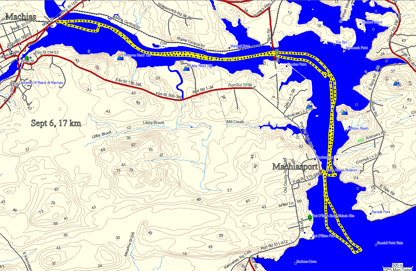
| Machias River |
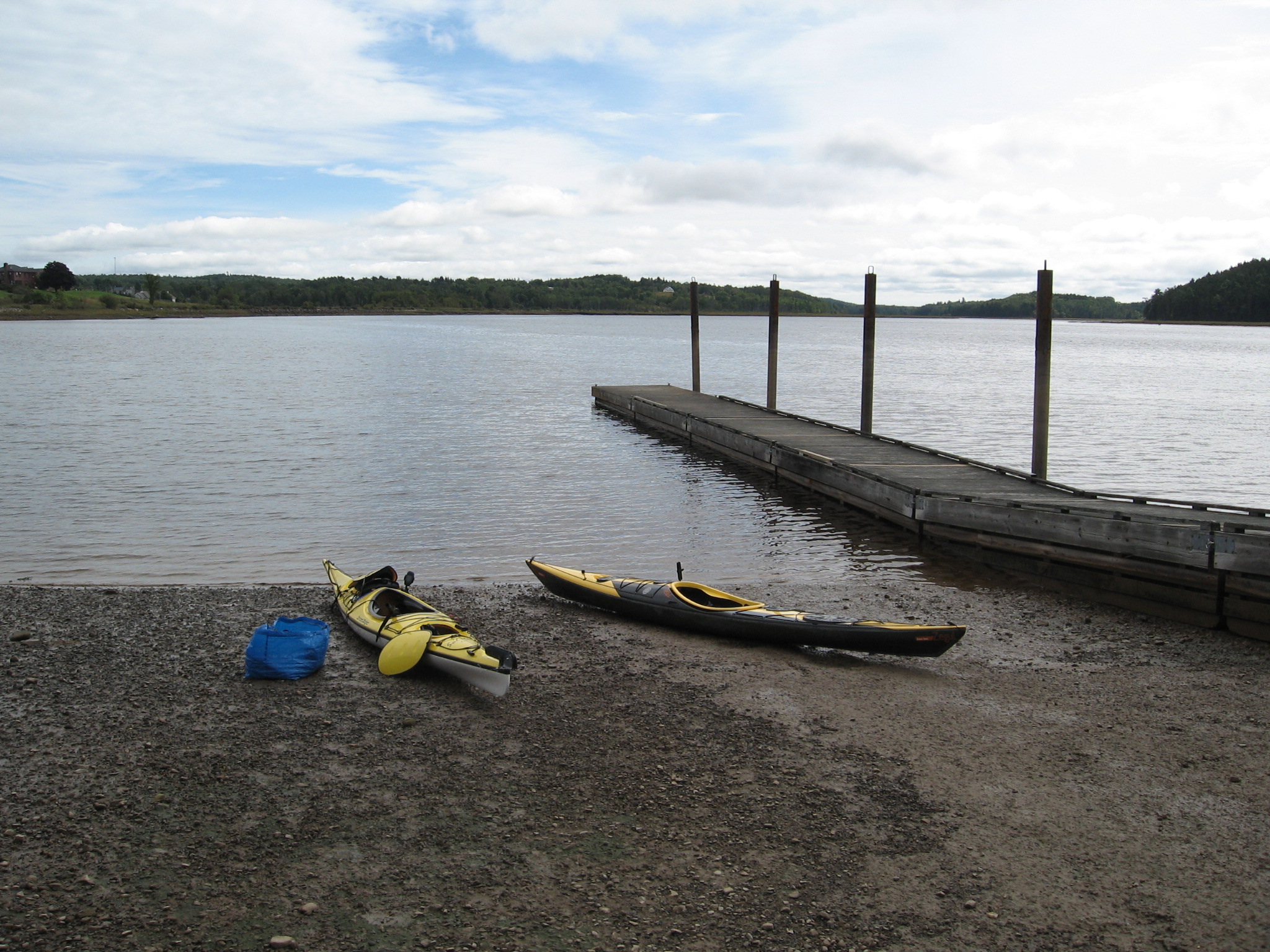
We arrive at the put-in with the tide about 3 hours before low tide and we wonder if we will be able to get out here if we are back at low tide. I ask a local for his opinion and he thinks it will be okay but probably landing on the mud. What is visible seems to be mostly gravel which should be okay, mud can be real treacherous! Today I am trying out George's old drysuit to see if I like it, see below.
 |
| Drysuits * |
 |
| Machias put-in |
As we paddle out into the middle of the river we notice the paddles are hitting bottom and are concerned we could run aground offshore as the tide drops. Luckily a GPS app on George's phone he uses to navigate mimics the hydrographic chart and indicates the position of the deepest part of the channel which we now follow. As the tide drops large mudflats extend out from the shore which we are careful to avoid.  |
| Machiasport ramp |
 |
| Machias River bridge* |
At a point just short of where the river becomes open sea is Machiasport where there is a concrete ramp and we decide this is likely our best option for a lunch stop.
 |
| George at lunch |
After lunch we paddle a few kilometers south into open sea before turning around and heading back to Machias. The tide has turned but we we retrace our route keeping to the deepest part of the channel. The day has turned very pleasant and bodes well for the rest of our trip. After getting our gear packed away and a shower and change we are off to Helen's for a seafood dinner. Tonight I decide to try wrestling with a lobster, when in Rome....
 | Andrea gives me a tutorial*
|

Howdy there* |
A great start to our Maine kayaking trip!
Jonesport
Day 2 and the weather is lovely, sunny and warm with light winds so we are off to Sawyer Square in Jonesport an area we paddled before on a previous trip. I decide to eschew the drysuit in favour of my dry top and pants which are much easier to get into and out of.
|
 |
| Jonesport |
 |
| Sawyer Sqr. Jonesport |
 |
| Jonesport |
We use the boardwalk to load up as trucks frequently come and go on the ramp to load up lobster traps etc. We head SE around the tip of Pig island roughly between Great Wass island and Harbor Head island in the hope we may find fish farms that were present here in 2019 which attracted a number of seals hoping for a free meal. I check with the binoculars but unfortunately they appear to have moved to another location. Plenty of lobster boats around and as they pass in a hurry they set up a good sized wave.
 |
| Lobster boat |
From time to time a seal pops up it's head very briefly making it difficult to get an image but finally one surfaces close to George and I am ready with the camera.
 |
| A curious seal |
Getting hungry we look for a safe place to land, preferably the beach we used back in 2019 over on Harbor Head island. I think it is in a cove where the name Sealand appears on the map but on paddling closer it all looks rather different no doubt due to the current state of the tide. So we abandon that and try for the next inlet a little to the north and find a gravel beach safe to land on.
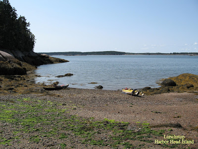 |
| Harbor Head island |
 |
| Me at lunch* |
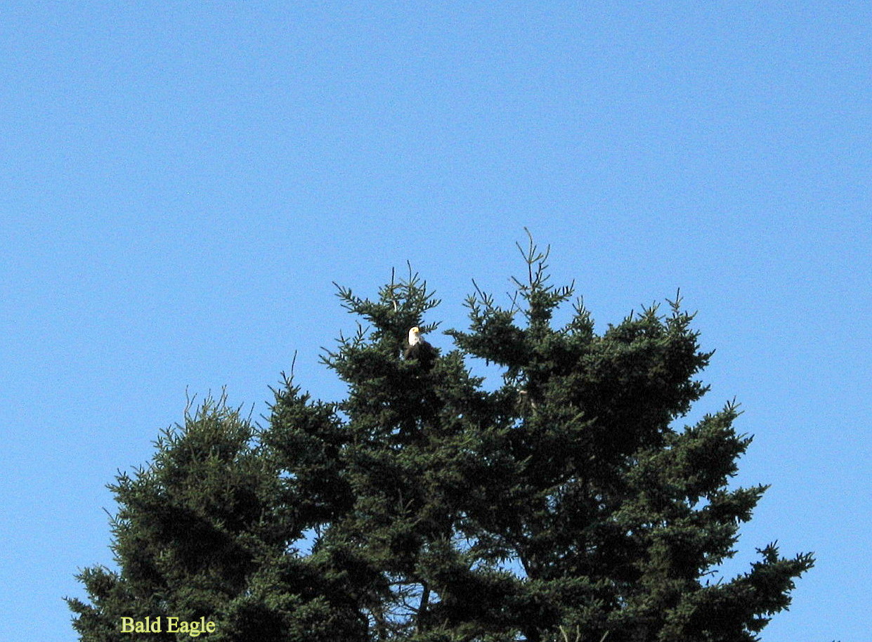
This beach is similar to one used in 2019 with good gravel and no mud so firm underfoot. Tide is still dropping and by the time lunch is over the kayaks are now about 20' further from waters edge. We decide to continue north rounding Harbor Head island heading east, then around Sequin island before heading back in the direction of Jonesport. Turning a bit NW we head toward Kelley Point on the mainland and as we draw close a Bald eagle flies across our path and I watch as it lands in a tree on shore. I leave George to head in to try for a photo.
 |
| Bald eagle |
With my point and shoot camera I am limited to 4x zoom but with cropping on editing I get something recognisable. Happy to have seen at least one eagle we continue on our way to Jonesport. Up ahead we can see the bridge from mainland leading to top of Beals island.
 |
| Beals island bridge |
Not long now before Sawyer Square ramp appears and we are done for today's paddling, all that remains is shower, change and back to Helen's restaurant for tonight's seafood surprise.
 |
| Dinner at Helen's* |
Winter Harbor
Our third day we take a break from kayaking and decide we will spend the day with the girls visiting our old stomping ground Winter Harbor where we used to stay for several years and have done a fair amount of kayaking on previous trips.
We visit the main street with its 5 to a dollar store and some souvenir type stores for the girls to shop. A few changes since we last visited, the Fishermans Inn a nice restaurant we used to patronise has gone. One of the first places we ever ate Chases restaurant is still there and that is where we have a nice lunch. Then we drive out Schoodic Peninsular part of Acadia National Park to Schoodic Point to take a few photos.
 |
| Linda and I * |
 |
| George * |
 |
| Andrea * |
 |
| Schoodic Point * |
Bucks Harbor
 |
| Bucks Harbor to Hog Island |
Today is our last day so we are off to Bucks Harbor for our last paddle in Maine. We have paddled here before on a previous trip and we arrive with the tide still high and find a spot at the end of a row of fishermens trucks and trailers to unload.
 |
| Bucks Harbor |
 |
| George getting ready to launch |
There are many boats at anchor in the harbor area sheltered by the surrounding islands so we paddle to the right past Bar island then Yellow Head before skirting the shore of Bare island as we check out some of the beach areas as possible landing sites.
 |
| Checking landings |
On a previous visit we had paddled to Hog island in search of some very unique petroglyphs which are to be found there, unfortunately we were never able to find them as it is a bit like looking for a needle in a haystack. We think we may as well go back there today for one more try and at least there is a good gravel beach where we can have lunch. So pulling away from Bare island we set course for Hog island.
 |
| Hog island in the distance |
No sign of any seals today but I get a brief glimpse of two dorsal finned backs as they break the surface and disappear, I'm guessing they could be dolphins as that seems to be a typical maneuver. Weather has been great and waves are at a minimum which is especially helpful out here where we are at some distance from shore. I would love to find the petroglyphs as they are unlike the ones we have in Bon Echo which are painted, these are carved in Bas relief and according to someone my wife talked to are to be found on a ledge somewhere on the south shore of the island. That is pretty much where I have looked previously so I don't hold much hope on finding but I will have another gander today.
 |
| Beach at Hog Island * |
While George sits to have his lunch I go for a walk (clamber) over the south shore which is basically just a jumble of rock so rather strenuous. No more luck than last visit, one would need detailed instructions or better yet a map location in order to find them. So back to the beach to have my lunch now. Lunch over we set course for Round island.
 |
| Heading for Round island |
From Round island we aim for the gap between Mountain Head and Bare island leading to Bucks Harbor. As we pass Bare island I suddenly recall that on our first visit here we looked seaward at low tide and realised you couldn't get out of Bucks Harbor this way as there was almost a wall running from Bar island over to Small Point and sure enough when I look with the binoculars there it is as the tide is now out. So reversing a bit we now turn and follow the seaward shore of Bar island to retrace our outbound course from Bucks Harbor.
 |
| The gap between Bar island & Yellow Head |
So all that remains now is to paddle in and load up the gear and boats although now our landing is much further from the car but there is a ramp so we use that and bring the car down to the boats avoiding a long carry.
 |
| Bucks Harbor at low tide |
Then, you guessed it, it is off to Helen's for our last seafood dinner in Machias and then bed for a good nights sleep before the long drive home tomorrow which should be a lot pleasanter than the one coming down as the weather is again expected to be perfect!
.jpg) |
| The last supper, Amen! |
 |
Happy paddling!
from
KayakJock |





.jpg)


