Thursday 23 September 2021

Bon Echo paddle

 Mazinaw Lake

    Note: Click on an image to see large.

Bon Echo

September 19 and my friend Pat and I head up to Bon Echo on what is looking like another spectacular paddling day all the better to enjoy the grandiose scenery of Upper & Lower Mazinaw lake at Bon Echo.  We both arrive about 10:00 at what I believe is the one and only public boat launch for Bon Echo.   Judging by the number of vehicles parked in the lot and along the access road it would appear that assumption is correct, but luckily we  find two spots for our cars.

Boat launch

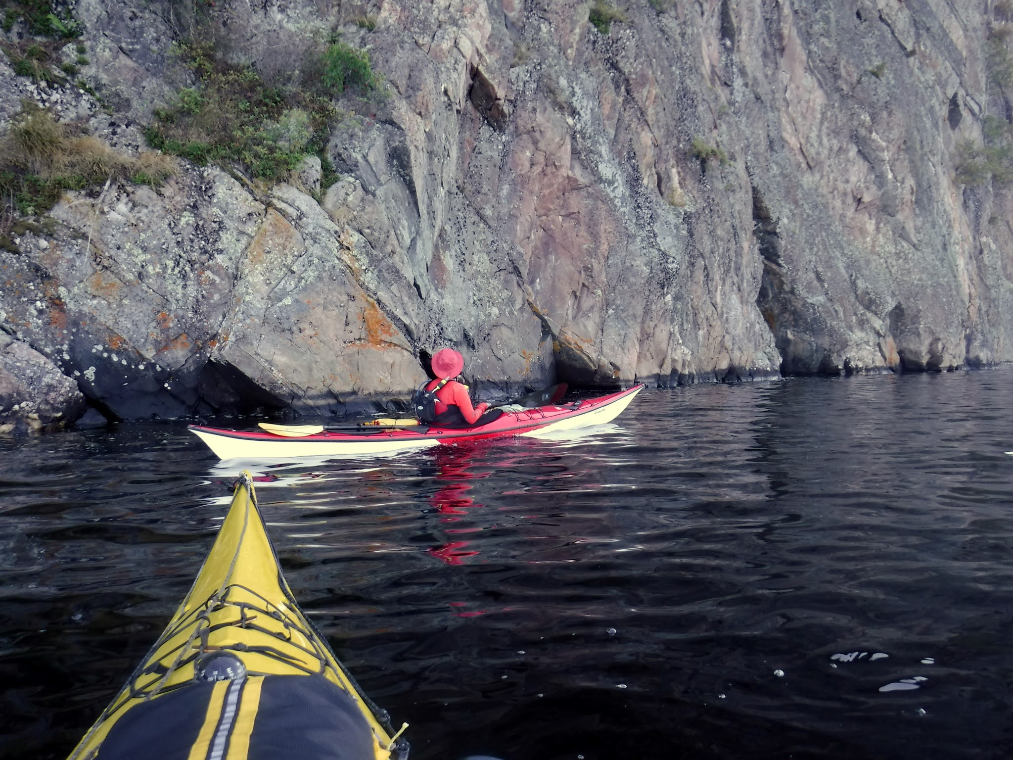
We are keen to check out the pictographs to be found along Mazinaw Rock close to the waterline so we head over towards the rock's northern end to work our way along the rock face looking for pictographs.  Upper Mazinaw is one of the deepest lakes in Ontario, coming in at 476 ft at it's deepest point. We are not disappointed as there are quite a number but many are so faded it is very difficult to determine what was drawn, not surprisingly as some are as old as 1000 years.

Heading for Mazinaw Rock


Pictograph

Below is a pictograph that contains the image of Nanabozho (bottom right) the Ojibwe trickster a stick like figure with almost rabbit like ears that is considered a mascot of Bon Echo and appears often.

Nanabozho (trickster)
   
Searching for pictographs

We spend quite a bit of time just drifting along examining all the pictographs we can find and by the time we reach the end of the rock face we are thinking of lunch.   It is worthy of note that Mazinaw Rock attracts many climbers and today was no exception as we see several pairs of climbers working their way up the cliff.  Definitely not for the faint hearted ( that would include me!).

Two climbers


Leading the way

As we are almost at the narrows, the juncture of Upper and Lower Mazinaw where there is a gravel beach for easy landing a kayak so we paddle over and take out for some lunch.  Before lunch we check out the tribute to Walt Whitman carved into the rock face by two of my countrymen (fellow Scots) in the summer of 1919 at the behest of Flora MacDonald an ardent admirer of Whitman and owner of the Bon Echo Inn.  Also noted for her work in founding the Canadian Suffrage movement.

Flora

 
Walt Whitman tribute

The dedication reads:
OLD WALT
1819-1919
Dedicated to the democratic ideals of
WALT WHITMAN
by
Horace Traubel and Flora MacDonald

My foothold is tenon'd and mortised in granite
I laugh at what you call dissolution
and I know the amplitude of time.


The beach at the narrows is within Bon Echo park boundaries so we get a fair bit of company as we sit and eat our lunch.  From here you have a view of both upper and lower Mazinaw lake.

Upper from Narrows


Lower from Narrows

With our luch over we paddle into lower Mazinaw lake with the intention of paddling the creek that empties into lower Mazinaw from Bon Echo provincial park.   The entrance is spanned by an attractive wooden pedestrian bridge which we paddle under to see how far up the creek we can get.


Bon Echo creek
Pedestrian bridge


As it happens going by Google Maps there is about 600m that looks navigable but I doubt we made 500m before encountering fallen trees which prevented further passage.   Leaving the creek behind we head back towards the narrows and upper Mazinaw passing a couple of beach areas to the left and a landing with some stairs on the right, this I believe leads to the trail which takes you up Mazinaw Rock which we will have to leave until another time, perhaps a future camping trip.  After passing through the narrows we can see our climbers are still hard at it and the lead is now much closer to his goal.

Almost there!

As we both have a fairly long drive ahead of us and I am expected home for dinner we decide to call it quits and head back to our take-out to load up.   If you have never been to Bon Echo I would highly recomend it as it is a lovely place to paddle and hike, we will likely be back probably camping so that we can fully explore all that this area has to offer.

Mazinaw Rock


Pat


Happy kayaking!

from

KayakJock


Wednesday 8 September 2021

Oiseau Rock revisited - Kayak camping on the Ottawa River

 Petawawa to Oiseau Rock

Note: click on an image to see larger

Oiseau Rock camping trip

September first and with a forecast for three days of sunny dry weather albeit likely rather windy days, we are at Petawawa ready to shove off for a couple of nights under the stars camping at Oiseau point beach on the Québec side of the Ottawa River.   After a rather long drive, almost 3 hours  I am loading up the kayak on the beach at Petawawa Point where there is adequate parking for us to leave our cars for the three days we will be gone.


Petawawa Point


Ready for anything?

As we head out the wind becomes very apparent and is likely around 20km from the NW so we decide to cut through the islands to use them as a bit of a windbreak as we travel upstream.    This part of the river is rife with shoals and with the chop it makes it more difficult to spot the rocks.   It is very slow going and after only about four and a half kilometers we seek shelter in a sandy cove to have some lunch but not before I almost got trapped on a shoal which the wind pushed me onto and I had great difficulty getting off.

Slow going

Lunch over we head back over to stay close to the islands trying to stay out of the wind and away from the Fort William shoreline where I know from past experience the shallows extend for some distance out into the river.   On a previous trip we ended up getting out of the boat and walking to deeper water!   After a rather tiring paddle we catch sight of our beach only to find we will not be alone as there is about four boats parked along the beach, hopefully we will not have any "party" boats to contend with.   On arrival we determine the east end of the beach will afford us the most privacy so we unload and get set up.


Our camp
Neighbours


After meeting with some of our neighbours our fears of party boats subside as this is an older crowd like us and content it seems to have some peace and quiet so all's good.     With the camp set up it is now time to start thinking of dinner as sunset is around 8 p.m. this time of year and we want to get all cleared up by then.   First though I prep the fire as Pat thoughtfully brought a bag of wood with her so I chop a bit of kindling and arrange on some paper I had brought.   I brought tonight's dinner, home made meatballs and Jasmine rice (curtesy of my wife) the meatballs were frozen and sealed in a plastic bag so can be heated in boiling water as can the rice which is precooked and sealed in plastic.  This was followed by some chocolate custard with fresh strawberries brought by Pat.    So after a satisfactory meal and a cup of coffee it is time to light the fire and relax till bedtime.

End of day 1

Neither of us appear in any rush to get up but by around 9 a.m. we are getting breakfast ready.  My call on this as I am making sausages with pancakes and the sausages will have thawed so best used first.  I check weather on my VHF and again wind from NW twenty gusting to forty so we will eschew paddling today and instead hike to the top of the rock.

Check the weather

One thing that's great about our camp is we are in a bay completely sheltered by the mass of Oiseau Point at our back but looking past the point to the main stream of the river the white caps are very evident.  I am aware there is a picnic table by the shore of the small tarn atop the rock so we will bring our lunches to eat after our strenuous hike which is around 40 minutes or so.

Are we there yet?
Hurry up!


Then one reaches the top and takes in the beautiful panorama that awaits and all that effort is suddenly so worthwhile.

Ottawa River from Oiseau Rock lookout


Oiseau Point

After admiring the view we retire to the picnic table by the tarn to have our lunch and relax for a bit before making our descent.

Lunch by the tarn

Suitably fortified we begin our descent which is every bit as tricky as coming up, at least the ground is dry although loose soil can make things slippery.   There is a knotted rope strung down the steepest part so you have something to hold onto.


Rope-a-dope?

Having made it safely back to camp we decide to take a walk on more even terrain following the shoreline southwards for as far as we can which is just over half a kilometer until you reach an impasse or have to swim for it.   In the image below taken on our walk you can see the beach with our camp at far right and the house boats parked to our left.

Oiseau Beach camp

Pat's turn to supply dinner tonight and she has a special treat, pizza; something I didn't think was possible when camping.   So while she cuts up the toppings I prep the fire for later. This pizza is done using a bake oven, a sort of frying pad with lid which goes on the camp stove then gets covered with a fireproof mantle to help keep in the heat, see below.


After
Before


Bake oven

Very tasty indeed!  The same device gets used next morning when Pat makes a frittata with sausage, feta, potato and eggs.  So another evening is spent round the fire gazing at the stars and then off to bed.

Close of day two

Our last day and we are up at seven to start breaking camp and packing up the gear before having breakfast.  The wind is less today but still NW gusting to 13 km but will be less of a problem being on our starboard quarter as we travel downstream.  When we are ready to leave we decide to paddle round the point and upstream a little to get a good view of the rock from the water.  I am gratified to see that there appears to be less graffiti than last time I visited, I'm guessing an attempt was made to remove some of it.

Oiseau Rock


Of course the world is not about to run out of morons any time soon so despite the new plaque describing the rocks heritage and making a plea to not despoil this archeological site there is still no shortage of graffiti some of which is quite recent as the perpetrators often date their inane scribbles.

Graffiti


Leaving the rock behind we head downstream towards Petawawa and ultimately home.  About 3 km downstream we round the bend where the lighthouse is, and now for at least 3 km we will be in the lee of the shore so calmer waters prevail until we pass Chalk Bay a large inlet to the NW where the wind will have a good fetch once again.  The scenery here is quite magnificent.

Heading downstream

Passing Chalk Bay we are back in the wind so now once again we will try to island hop keeping the islands to starboard to try and keep us out of the wind which is gusting quite strongly at times.

Getting a push from the wind

As we come to Oak Island there is a sheltered cove where we turn in to make a pitstop and have a snack.  From here it will be a bit over 6 km to Petawawa Point.

Snack time
Oak Island


As we get closer to Petawawa I try to remember where I found a channel closer to the Ontario side on a previous visit and we head for the first opening I see only to find when close enough there is a line of breaking water stretching across it and with the wind I'll not risk getting swept on to another shoal.  So turning left we look for another and spot a channel marker where we make a right and can  now see we have a clear path to Petawawa Point.    After packing up all the gear and tying down the kayaks we drive over to the nearest McDonalds to get some cold drinks before beginning the long drive (for me) home.  This brings to an end  what was a rather pleasant three day camping trip, the wind was tedious on the outbound leg but no bother at the camp and finally I get a camping trip without a torrential downpour, like my last two this year.


Happy Kayaking!

from

KayakJock