Showing posts with label Oiseau Rock - Ottawa River paddle. Show all posts

Thursday, 17 September 2015

Deux-Rivières Ottawa River Kayak Camping

Deux-Rivières

The village of Deux-Rivières lies along the shores of the Ottawa River a little more than 100 kilometers west of Petawawa and about 35 east of Matawa and offers not only spectacular scenery but a truly wilderness camping experience for kayakers.    The Ottawa is quite wide here, although this was not always the case, the building of the Swisha Hydro dam in the early 50's changed the shape of the river and even required the moving of the village inland to accommodate the rise in water levels.  Today there is but a few houses and a hunting/fishing lodge and kayakers are likely to only encounter the odd fisherman as they travel this beautiful historic waterway.

Deux-Rivières outbound
This fall the weather has been perfect for camping so a friend and I decided to head up to Deux-Rivières for a couple of nights camping and three days of great kayaking.   For me this is a 3+ hour drive, stopping in Ottawa to pick up my companion and his gear.  The route is the Trans-Canada highway more or less following the course of the Ottawa River much of which I have kayaked at one time or another, some of  which is covered in previous blogs, notably Petawawa and Deep River.    We arrive at our put-in around noon so take time to have lunch at the picnic table provided before loading and launching our kayaks.


Then we are off downstream with a brisk wind at our backs so we are making good time; I clocked 8 km/hr at one point in mid stream, this is all good in case we have to search for an alternate site.   The thing about camping in fall is the ever shortening days so you want to get on site and set up before dusk.   I am hoping for an excellent site I used before when kayaking here with another from our group in 2010.   The kayaking possibilities of this area were brought to our attention back in 2009/2010 by a kayaker who was then stationed in Petawawa and the Ottawa River was his backyard.  The shoreline for the most part does not lend itself to camping, being very steep and heavily treed so suitable campsites are few and far between.  There are a couple of spots on islands very close to Deux-Rivières and an abandoned trailer on the Québec shore around the seven kilometer mark that could be used in an emergency. But the one we want is about 14.5 km downstream.  We had not gone too many kilometers downstream when we spotted our first Bald eagle, an adult, then a little farther on an immature and another adult, probably all of the same family.  I have seen quite a few this year and it is nice to see as this species was at one time very endangered.


Ottawa River
Leaving Deux-Rivières


Happily when we arrive at our chosen camp we find it unoccupied.  On the way down the only traffic we encountered was two small fishing boats, the occupant of one stopping to chat with us.


Our campsite

After getting tents up we set about gathering fire wood so there can be a campfire later in the evening; that done it is time to have dinner.  It has been a lovely day and we now get an equally lovely sunset.


View up river
Sunset


Day - 2
After a crummy night; I had trouble with a leaky air mattress and switched to another, we awoke to a misty morning.  Around 8:30 the sun broke through and the mist quickly dissipated leaving us with another brilliant day.  We had hung our food bags up in trees just to be safe, so first order is to retieve them before frying up some breakfast.

Mist
Sun out
Breakfast over it is time to head out and explore the river downstream of our camp.  About 100 meters down from camp there is a small, very pretty waterfall which we stop to admire.   Then I flushed a spotted sandpiper, a species quite common to the shores of our lakes and rivers in eastern Canada.  Shortly thereafter an American pipit lands, its tail pumping vigorously.  Likely on migration at this time of year.   Staying close to the Quebéc shore the river suddenly widens after about four kilometers with a large bay on the Ontario side, there are two large islands, the larger Rocher Capitaine Island close to the Ontario side with a smaller one unnamed, about 300m from the Quebéc shore.  Ray notices the name Maraboo Lake on the map and he has some personal association with this name so would like to check it out.   Good a reason as any for some exploration and I believe there may be a campsite around Maraboo Point so this becomes our next destination.  Some lesser islands straddle the Quebéc side and we wind our way through them before crossing to the Ontario side.  I thought one would be well suited to the name Christmas Tree island.

North shore islands

Christmas Tree Island ?
Rounding Maraboo Point towards Maraboo Lake we find a very nice campsite; I forgot to mark it on the above map but it would be on your right as you head SE and is quite obvious.  I should mention these sites have had no development other than a fire ring, so don't forget a trowel if you plan on camping.


Campsite near Maraboo Pt.
Although the map shows a clear channel to Maraboo Lake this is not the reality and we poke around looking for a way in.  Below right turned out to be it, I ended up exiting my kayak and dragging it over a partially submerged branch, Ray's approach was more successful.  Worth the effort as we emerged into a lovely little lake which also has another nice campsite.  I doubt that you could ever make use of it kayaking as it would be near impossible to get a fully loaded kayak through that entrance.  We notice a small dock on the east side and go to investigate.

Dead end
Way in


Maraboo Lake
A trail leads from the dock to a cabin obviously accessed by a logging road, this can be seen on Google aerial photography as it takes a torturous route back to highway 17 near Bissett Creek Rd.  Nobody home but a permit on window from Ontario regarding trapping and recreation.  After a quick look around and paddle up lake it is back to the camp on Maraboo Point to have lunch.


camp on Maraboo
Exit Maraboo


Lunch at Maraboo Pt.

After lunch our route going back will be by way of the large bay on the Ontario side known as Holden Lake, circling around Rocher Capitaine island coming close to Bissett Creek thence along the Ontario shore.   Really nothing at Bissett Creek, couple of houses and a railway bridge (Ottawa Valley Railink) which crosses highway 17 which is almost at waters edge here.


Bissett Creek, hwy 17 far right

Heading upstream
From here back to camp we are staying close to shore to make use of the shade provided by trees on a steep shoreline.   Of interest is a put-in I discover not far from camp on Ontario side, this could be used to camp if you found our camp occupied and were running short of time.   Easy landing with nice grassy flat area big enough for a couple of tents and connected to yet another logging road.  A boat has been stashed in the bush.

put-in?
Time for a swim


It is now a short paddle back to our camp and for me the first order will be to have a refreshing swim and a bit of a wash before we set up a fire and begin the dinner preparations.

Another perfect day

Our third day is looking as good as the others and it is time to pack up and head back to Deux-Rivières then home.  We can have a late, maybe quite late lunch on the drive back to Ottawa, that way we spend a little more time on the water exploring shoreline missed on the way down.

Day 3 home-bound
We start along the Quebéc shore then switch to the Ontario side trying to keep opposite from our downward course.   One finds amazing growths of mosses along the shoreline rocks, a couple of examples below.

Leaving camp

Moss
Moss


We come across another small dock in disrepair almost hidden in a niche, with a rickety stair dropping almost to the dock.   I park and climb to investigate.  Looks like there once might have been a trail now completely overgrown which would have lead to a logging road and probably a cabin of sorts.   This seems to get confirmed as a short way along the shore we find a newer dock no doubt leading to the relocated cabin.   Now we are going back to other shore to visit falls we spied on our first day.  This one a little larger with decent volume and I take this opportunity for my photo op.


Falls
From here it is not much further to where we put-in at Deux-Rivières where we take out, unload and pack up the car before taking one last refreshing swim off the public dock.   Then  it is the drive home stopping first for gas at Deep River then Petawawa for some fast food.  Another nice fall kayak camp is over!

Isles near put-in
Deux-Rivières put-in


Happy paddling!

Doug

Wednesday, 12 September 2012

Oiseau Rock-Ottawa River Paddle


September 7, a friend and I set out from Petawawa on a weekend kayak camping trip up the Ottawa River, our destination Oiseau Rock and perhaps Deep River depending on weather conditions which were not looking at all promising.  I had paddled the area before but had little time for exploration on the previous trip and this was the first time for my paddling companion so we were determined to make a go of it despite unfavourable weather predictions.

Petawawa Point

Oiseau Rock or bird rock as we would literally translate to English is a massive cliff (150 metres or 492 feet) looming over the Ottawa River just a few kilometres downstream from Chalk River nuclear facility and named bird rock by Algonquin Indian peoples to honour the Thunderbird held sacred by them and epitomised by the  Peregrine falcons which once nested there in significant numbers.

Weather was pleasant as we put in at Petawawa Point following the channel markers to reach deep water and avoiding the many shoals among the islands off Petawawa.
On return we tried a more direct approach but encountered shoals between Indian Pt. and Lilian Is. so would recommend staying with the channel even in a kayak.   It is only about 15.5 km to Oiseau Pt. where we planned to camp so we take our time and enjoy the scenery.   The east side of the river as you travel N or NW has shallow sloping shore that may extend for 200m offshore and at one point we ran aground on soft sand forcing us to get out and tow our kayaks about 50m further out to find deep enough water so I suggest taking a course that keeps the chain of islands; Pearl, Oak, Shoal,  Irving, Davis etc close, just off your starboard beam which will keep you in deeper water.  The west shore north of Petawawa to Chalk River is DND property and is posted so we decided to wait till Pointe Malin where there is a small islet with a navigation light just off the west shore where we could stop for lunch.  There is a channel between the islet (Deep River Islet) and the posted mainland which during times of high water may be navigable by a kayak.
Light on Deep R. Islet
Looking south from Deep R. islet

On arrival at Pt. a L'Oiseau we set up camp, I decided to opt for some shelter as the Saturday forecast was for 20km wind and rain.  We moved a picnic table to higher ground that we might set up some tarps.
My tent & our sheltered table

As the day was still nice we decided to take the hike to the top of Oiseau rock while the ground was still dry fearing Saturday's weather might make the trail too treacherous.
 trail up Oiseau Rock

Are we almost there?
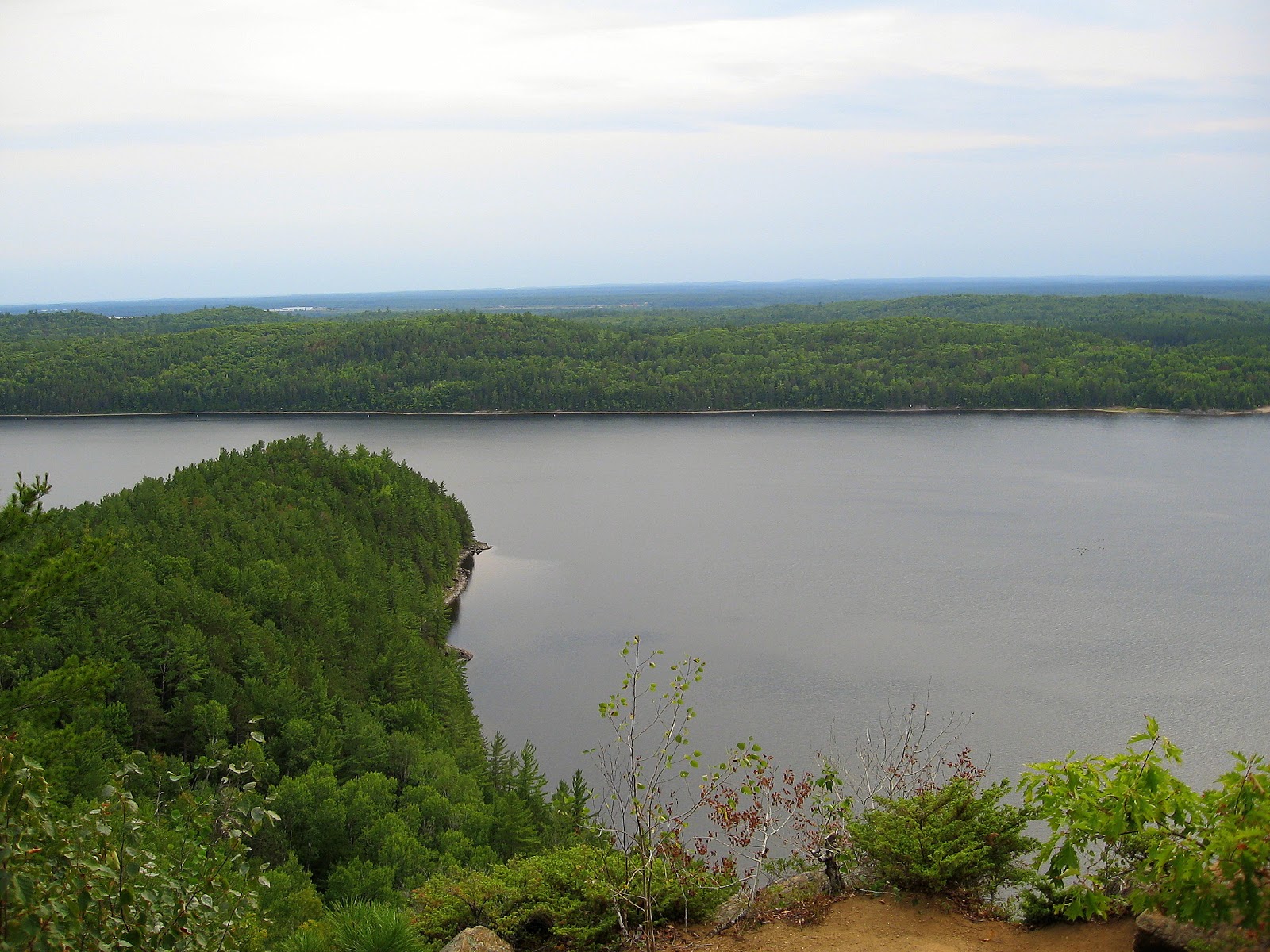
Reaching the summit one is rewarded with a view that makes all that effort worthwhile, looking to left of image you can see Oiseau Pt. reaching out into the river, our camp being on the other side so hopefully protected from the NW winds expected Saturday.
Looking west
Looking NW or up river
From the lookout a short trail <100m runs NE to a tarn on top of the rock where there is a picnic table, where if you had the foresight to pack a lunch one could sit and enjoy a meal.
Tarn atop Oiseau Rock
The winds began during the night and Saturday dawned wet and blustery, wind although blowing down river, yet strong enough to eddy back into the bay to rattle our tents and shelter; not a day for paddling. 

 When it lets up somewhat in the afternoon we hike the lower trail to the lookout facing the cliff.  On examining the cliff face through binoculars I am greatly disappointed to see the extent of graffiti defacing the natural beauty of this timeless landmark and all but obliterating, or at least rendering them indistinguishable, the pictographs placed there by native peoples.  The interpretative sign tries but fails to guide the viewer past the etchings of imbeciles to the placement of the pictographs.  It almost seems as if some tried their best to obscure them by using a red paint similiar in pigment to that used by the native people.
Oiseau Rock from lower lookout

Graffiti

I think, that in my ideal world, that somehow by removing these mindless scrawls magically by the same act we could erase Sharon, Blayne, Scott, Rick and others of their ilk from the gene pool thereby safeguarding this heritage for future generations to enjoy. Hah...if only! 
Rainbow after the rain
Around 6:30p.m. skies clear again and we are presented with a rainbow which seems to indicate the pot of gold might only be a couple of kilometers offshore, hmm..
Sunday is a decent day, mostly cloudy with about 10k wind from NW so we will have a tail wind on our return journey.  We paddle round to get a close up of the cliff face from the water and the solitary chimney like rock created by glacial forces before turning about and heading downstream towards Petawawa.

150m/492'

Rock tower
We retrace our route back to Petawawa Point arriving at the beach around 4p.m. feeling satisfied that we had made the most of a less than ideal weather weekend and are a little more knowledgeable about the area.