Grenadier Island
Finally a perfect day to paddle and enjoy the beautiful Fall colours after several days of high winds and intermittent rain. So ideal for a circum-navigation of Grenadier Island and being a weekday not likely to be much boat traffic to interfere with our enjoyment of the peaceful surroundings. Arriving at the Parks Canada Mallorytown Landing boat ramp we are happy to find that we can park for free as the self serve machine has been taped up and is not in service, an added bonus!
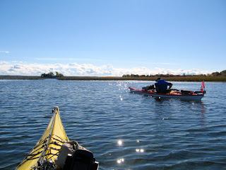
Three of us today and we launch from the beach behind the visitor centre rather than use ramp thereby avoiding any boaters with trailers etc. From the beach we head SE for an open water crossing of just over 2 km to reach the marsh at the NE end of Grenadier. This is a rather pretty area where you might find Mute swans, ducks and the occasional marsh bird like Pied-billed grebe. It is also fun to paddle through the marsh grass.
There are two distinct channels through the marsh, we take the right one which will angle over towards the bay leading to Grenadier East, one of several camping areas on the island. Rounding the NE corner of Grenadier we will now travel SW along the outer shores of the island as we head to Grenadier Central the largest camping area where there is a beach and we can stop for a lunch break.
On this side of the island you are but a short distance from the international border and the shipping channel which lies just within U.S. waters. About 1/3 of the way to our lunch stop we pass Sister island with it's lighthouse which almost straddles the Canada/U.S. border but actually is on the U.S. side. Also of interest in this area is a wreck site in the bay west of Sister island, in calm water and the right light some of the long timbers can be seen from the kayak. It used to be marked by a plastic bottle float which seems to have since disappeared.
 |
| Position approximate |
Just after passing Sister island we get a good view of a vessel as it heads downstream, an oil/chemical tanker the Atlantic Spirit destined for the Netherlands.
 |
| Atlantic Spirit |
Approaching Grenadier Central we are treated to a blaze of Fall colours and tranquill waters as we paddle in toward the beach to take out and have lunch.
 |
| Grenadier Central |
In the summer this bay gets quite busy as many boaters choose to anchor here as being very shallow it is a great spot for swimming, but today thankfully we have it all to ourselves.
After lunch we continue with our SW travel until we round the end of Grenadier through the channel past Little Grenadier and Buck islands before turning NE to once again follow the shoreline of Grenadier going back towards Mallorytown. At this point to the west we can see the Ivy Lea international bridge and off in the SSW we can just discern the rooftops of Boldt Castle above the treeline.
 |
| Ivy Lea Bridge |
In this channel we pass the docks of Grenadier West which has docking facilities but no camping just day use.
 |
| Private property near Grenadier west |
We will continue this course until reaching Squaw island which is separated from Grenadier by a grassy marsh which although very shallow can be navigated by a kayak. Just before this is a large wheel in the water, not really sure what it is but it makes for an interesting photo.
 |
| Mystery wheel |
Just shortly after passing Squaw island we set a new course northward which will bring us back to Mallorytown Landing to end our paddle.


