Showing posts with label Frenchman Bay. Show all posts

Tuesday, 21 July 2015

Sea Kayaking at Mt. Desert Island Maine Day 5


Frenchman Bay - Bar Harbor to S. Gouldsboro


Our last day paddling and a trip to Mt. Desert Island would not be complete without a paddle on Frenchman Bay, so it is off to Bar Harbor to launch.

Bar Harbor to S. Gouldsboro

Parking at Bar Harbor is a problem,  maximum is 3 hours near the waterfront, but I know the overtime ticket is $15 and we figure that it is worth that for a days parking and to be close enough that we can carry the kayaks down onto the beach. The township didn't disappoint us!   The Margaret Todd sits at a wharf minus her sails; this sailing ship usually plies the waters of Frenchman Bay on short excursions but looks now to be laid up for maintenance.   Again the weather does not disappoint, very hot and the water very calm; was actually hoping for some wind to get some wave action but I can't complain!   Tides out at this time of day so we have a little further to walk the kayaks to reach the water, see below.

Beach below promenade

Our heading will be roughly northeast as we follow the line of the Porcupines on their south side towards Jordan Island, then South Gouldsboro beyond it.


Burnt Porcupine and Rum Key


self at Long Porcupine (image by Terri)


There are some caves around Long Porcupine; carved out of the rock by eons of wave action, and I notice a small raft of Black Guillemots flying back and forth between water and ledges within the cave.   They likely nested there in the spring and are now using it as a roost.  Guillemots are very common in these waters.                                                                                                                                                  


Long Porcupine

Caves


From here we continue northeast along Long Porcupine then cross over to Yellow Island at the tip of Jordan before heading in to S. Gouldsboro for lunch.
At S. Gouldsboro there has been changes since I was last here two years ago.  A large seawall has been built of rocks on the south side of the ramp and is about 30' high with a wooden platform on top, equipped with a gantry for unloading vessels.   At high tide this would allow a vessel to unload and be protected from the seas.


Looking SW from seawall
Looking down from seawall


Leaving S. Gouldsboro we head for the Hop, the small island at the NE tip of Long Porcupine, this time staying to the north of the Porcupines as we make our way back to Bar Harbor.

Cadillac Mt. Mt. Desert Island

Bar Harbor Inn

Back at Bar Harbor our Maine paddling  trip is over, but there is still time for another feed of scallops before getting an early night as I plan to leave for home at 07:00.   I'll leave my readers with one more picturesque view from the coast road.

Near Tremont


Sunday, 19 July 2015

Sea Kayaking at Mt. Desert Island Maine Day 3

Somes Sound


Somes Sound
Leaving Manset


Today was predicted to be our weather day; mostly cloudy with  possibility of rain and thunderstorms.   So we figure this is a good day to paddle the Somes Sound, a narrow inlet running north - south in the center of Mt. Desert Island and very protected from weather.   The put-in is again Manset town pier, and weather is looking much as was predicted, foggy and very humid almost precipitation but not quite.  As we head northwards towards the entrance of the sound the fog appears to be slowly dissipating.   It is low tide again and I notice some startling differences from the last time I paddled here two years ago.   There is a water fall called Man O' War Brook at the base of Acadia Mountain  which has been reduced to a mere trickle from a very picturesque cascade in the fall of two years ago.

Saint Sauveur Mountain

2 years ago
Falls now


By the time we are half way up the sound the weather has cleared up and once again it is a brilliant day, albeit rather muggy.   Having made good time we check out the picnic area on the east shore but decide to wait till we reach the top before stopping for lunch.  Also being low tide the picnic area is not the most accessible due to all the exposed rocks.  As we turn in to the northwest channel (really) I get my first sighting of a seal, almost missed it lying stretched out on an exposed rock, it dove as soon as I spotted it but I caught all but it's head on the image.  The pier at Babson, the northern most point of the Sound is private, as are a great many all around Mt. Desert Island.


Diving seal
Babson town pier

We land on the gravel beach behind the dock, and below the high water mark but take advantage of a bench supplied for residents use, as well as their port-a-potty!     Lunch over it is back to the water for a couple of hours paddling back to Manset under sunny skies.

Somes Sound

U.S. Coast Guard

Along the way we have a Coast Guard vessel give us a look over as it slowly passed, then gave us a wave and was gone.    Off Greening island we paddle through a flotilla of sailing dinghies practicing maneuvers, and then we are back at Manset pondering the big question, will it be fish or scallops tonight?

Sail boats

Below is a scene of the kind that you encounter almost anywhere along the coast roads of Mt. Desert Island, one of the prettiest spots in Maine.

Scenic view from highway

Continue with Day 4


Sea Kayaking at Mt. Desert Island Maine Day 2

The Quietside: Seal Cove

Today we plan to put-in at Pretty Marsh which is about the mid-point north - south of the western shore of the island.   From there we will travel south to Seal Cove, stopping for lunch before returning to Pretty Marsh or rather Bartlett Landing, which is where the ramp is located.

Pretty Marsh to Seal Cove

As we head SW, Bartlett Island is to starboard passing between it and Folly Island in seas that have just a little chop, the weather is once again beautiful.


There is no traffic and indeed in that respect it is the quieter side of the island as Frenchman Bay has ferries, fishing boats and cruise vessels of all types and sizes.  Here there is evidence of lobster fishing, buoyed trap lines but no one out tending them at this time.   There was a little delay in launching as we had to wait while a group of kayakers from one of the several Bar Harbor tour companies got their ducks in a row and cleared the ramp.  As we get close to Seal Cove I can just make out a tall ship on the horizon to the south, a two masted ketch I believe.  Then we are turning to port and the dock at Seal Cove.


2 masted ketch

Approach to Seal Cove

At Seal Cove we land on a sheltered gravel beach beside the ramp, carrying the kayaks about 20' above the water line; the tide is coming in so by the time we finish lunch they will be almost in the water.   Finding a picnic table with a lovely view of the cove we can settle in and have a relaxing lunch before heading back to Bartlett Landing.


Lunch stop
The view of Seal Cove


On our return paddle the weather is changing, becoming overcast and a little blustery.  The next day is supposed to be cloudy with the possibility of some rain so perhaps it is starting to move in now.   This has been another great paddle and tonight I will be cooking my own food back at the camp for a change, although I suspect it may be a one off!


Return to Bartlett Landing

Bartlett Landing


Continue with Day 3

Friday, 17 July 2015

Sea Kayaking at Mt. Desert Island Maine Day 1

Mt. Desert Island

This July (6 thru 10) I traveled to Maine with another paddler on a camping trip specifically to paddle the waters surrounding Mt. Desert Island and Acadia National Park.   In particular I planned to paddle the western coast which is usually referred to as the Quietside,  so called as it is more sheltered than the eastern side (Frenchman Bay) or southern shores.  The other side I have paddled before.

Mt. Desert Island

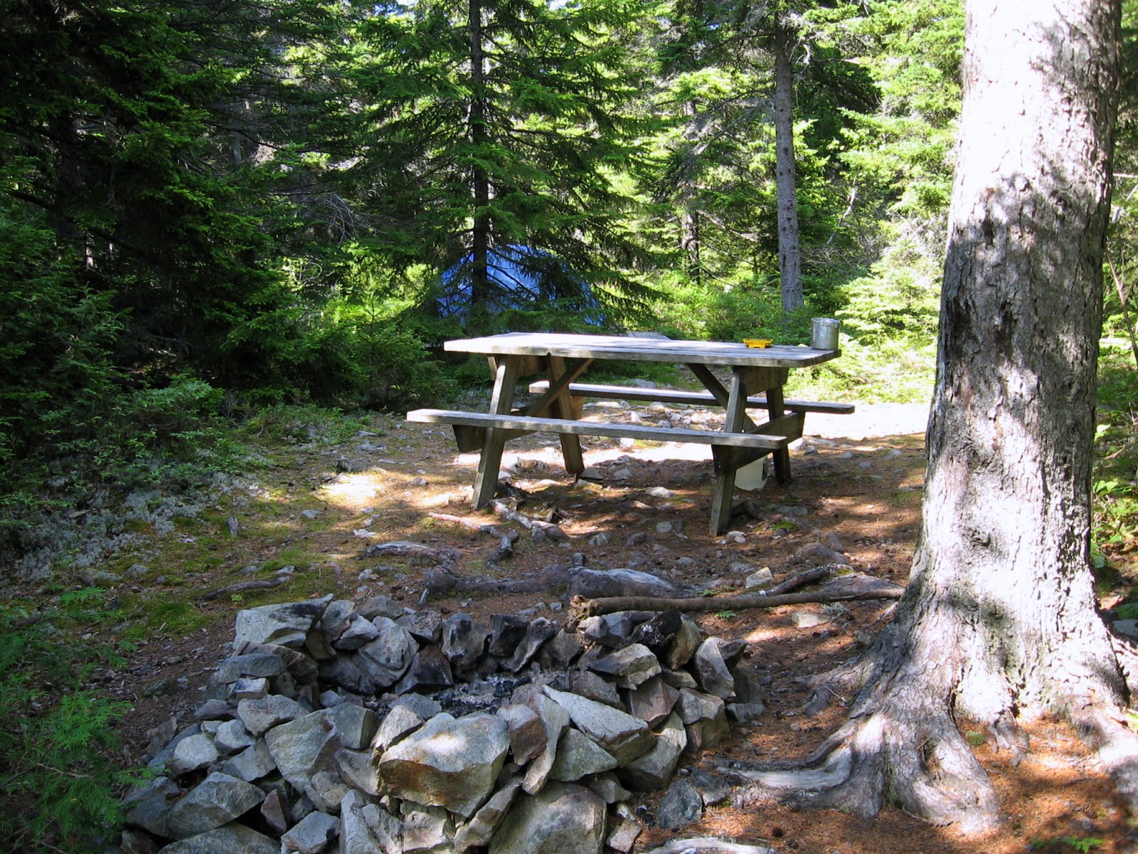
As it turned out with a week of gorgeous weather, hot and dry with very little wind to speak of, any side could have been considered the Quietside.  We arrive on the Monday after lunch and get set up in our campground; I'm using my tent, my friend has an electric/water site as she has a trailer.  I'm very happy with my site, lots of privacy with a tent platform set apart from the picnic table and fire pit.   My parking is very convenient too so I can haul gear in and out as it is needed.


Campsite

With everything shipshape we are ready for our first paddle, a short one but it is too nice an afternoon to waste sitting around.  So we head out to Manset town pier to launch.   Leaving Manset we travel east towards Sutton Island before turning northwest back towards the entrance to Somes Sound, rounding the northern tip of Greening Island thence southward to return to Manset pier.


off Manset town pier


Acadia Park Mt. Desert Island


Greening Island home

With our first paddle complete it is time for a much needed shower and change of clothes; wearing a wet suit in these temperatures one feels pretty cooked but water temperature averages 59 degrees which is pretty cool if you get dumped. Then it is off to have dinner at a restaurant in Bass Harbor which was highly recommended to us.  Excellent seafood!

Sunset from Bass Harbor restaurant

Paddle Day 1
Continue to Day 2


Tuesday, 17 September 2013

Kayaking Frenchman Bay Maine

Ironbound and Jordan Islands

Frenchman Bay

This is an area I never tire of kayaking there being so many bays and islands to explore, and with Mt Desert Island as a backdrop the scenery is without parallel.   There are a couple of excellent put-ins that I have used that are within a short drive of the inn we stay at in South Gouldsboro,  Bunker Cove wharf is closest and is best as you can park very close to the boat ramp and even at low tide the bottom of the ramp is almost awash.  Our first day kayaking and the bay is shrouded in fog so visibility is not great but being familiar with the area and having GPS we plan to head out with a mind to staying reasonably close to shore.  We park at Bunker Cove, this is an active fishing wharf so we are careful not to block access to any fishing boats or property not wishing to undermine our welcome for future visits.
Bunker Cove wharf
Weather on the coast is varied and can change fast and fog is something you can count on.  On this occasion visibility is probably 100 - 150 m and is not likely static but with GPS we will have no problem finding our way, just have to keep an ear to approaching traffic which might not see us.


Left, lobster boats in the cove.

Right, paddling in fog.


Not a great deal to see once you get away from shore but eerily calm in the fog as we proceed southward toward the passage between Jordan Island and the mainland.   Lobster pots are everywhere and the throb of the fishing boats engines is heard intermittently and every once in awhile their ghostly shape comes into view.  We look forward to a later rendezvous with some of their tasty catch in one of the fine dining establishments of the area.


By 11:30 we are abeam of Crow Island just off Grindstone Island which is in fact really a peninsular providing shelter to Winter Harbor, our planned destination this trip. Tide is still going out so we think we can park on an exposed sandbar to stop for lunch.  Lunch over we head SSE to round Grindstone Point then north to stop at Inner Winter Harbor for a quick pit stop before ending at Henry Cove to view the town of Winter Harbor.  This is as far as you can go so turning around we head back to Bunker Cove.
Crow Island
Lunch parking

Town of Winter Harbor
On our return trip we pass our sand bar used for parking at lunch, now it is high and dry and quite inaccessible due to all the exposed rocks, timing is everything in this environment.  For variance we decide to go further from shore cutting between the north end of Ironbound Island and Jordan Island thence along it's western shore passing Yellow Island before turning NE back to Bunker Cove.   As we approach this channel the fog thickens seemingly snagged on the islands, relying on GPS I steer for the gap and am almost on top of the island before I can see it.  Clearing the gap we emerge in the clear the fog being held by the islands but now as we look to the NE Bunker Cove and the mainland are now obscured.   Tide is low and fog thick as we arrive back from our 23 kilometer trip feeling we made the most of a foggy day in Maine.

Looking NE

Bar Harbor and Porcupines

This time we have a gorgeous weather day ideal to make the trip to Bar Harbor which is on Mt Desert Island about 9 km across Frenchman Bay.   There is a string of islands running roughly east west called the Porcupines and we can stay on their leeward sides if necessary to shelter from wind but it is looking good.  Once again we launch from Bunker Cove heading SW between Stave and Jordan islands heading for The Hop at the eastern extremity of the Porcupines 

Bunker Cove
Mt Desert Is.


Staying along the north shore of Long Porcupine we paddle SW towards Burnt Porcupine, here the retreating tide has exposed a stony beach where a quick  pit stop is made.   Clearing the southern tip of Burnt Porcupine we can now see a large cruise ship anchored off Bar Harbor.
SE tip of Burnt Porcupine

Bar Harbor is a major tourist destination situated as it is on Mount Desert Island part of Acadia National Park.  It offers all the amenities as well as opportunities for hiking, sailing and cruising for both whale watching and sightseeing, and is port of call for many large cruise ships like the Holland America line's MS Veendam pictured below.

MS Veendam

It is also the terminal for the hover-craft service from Nova Scotia so the harbor area can be quite busy with a variety of craft.   Sliding past her bows I'm thinking if she were not at anchor I doubt we would be getting into any kind of argument as to who has the right of way here. We head in towards a horseshoe beach below the promenade in front of the Bar Harbor Inn.  I had scouted out possible landing areas when on a previous visit with our wives so even if the tide was in there is a ramp to get us up from the beach.

On arrival we take our lunches and stroll up the ramp to the promenade to seek out a bench where we can sit and eat lunch.  Here one can enjoy a view of the harbor while basking in the autumn sunshine.   The Margaret Todd, a stately tall ship sits by a wharf in preparation for another cruise of Frenchman Bay as a whale watching catamaran makes for open sea with the Porcupines straddled across the bay beyond like so many green gems.   I take a quick walk into town to pick up a T-shirt I had meant to purchase on my previous visit leaving my friend to keep an eye on our kayaks.    It is now time to make our way back to Bunker Cove, and as we head out the Margaret Todd is now off our port side under full sail as she takes another load of


 tourists around the bay.   We are aiming for the southwest tip of Long Porcupine to look at the caves before paddling along it's rugged east side.    Then turning northward we will round 

Margaret Todd
the northern tip of Stave Island before returning to Bunker Cove having traveled 22 km this trip.

Long Porcupine
Rounding Stave Is.


Bunker Cove to Bar Harbor