Showing posts with label Quietside. Show all posts

Tuesday, 21 July 2015

Sea Kayaking at Mt. Desert Island Maine Day 4

The Quietside: Bartlett Island

Bartlett Island Day 4

Today we are back at the Pretty Marsh put-in, Bartlett's Landing and it is once again a nice day.   This has to be one of the busiest put-ins on the island, it seems all the kayak tour companies bring their customers here.   One of the trips they do from here is northwards up to Clark Cove which I had considered doing today but there is no public dock or parking at Clark Cove and although I have a possible "in" with someone who owns property there, the fact that we would arrive at low tide it might be very difficult to get ashore so we will go part way then circumnavigate Bartlett Island instead.

As can be seen in the image below there are many who are not too concerned about cold water, note the paddle board with someone in a swimsuit, and for the tourists brought out by the kayak tour companies, T shirts and shorts are the norm.  I grudgingly stick with my wet suit!

off Bartlett Landing

Bartlett Island was first settled in the late 18th century and today is mostly owned by David Rockefeller and has been in that family since early 1900.  It is my understanding that short term landings on the beaches are permitted and done regularly by the tour groups.   Parking is very limited here and we wait for a tour group multi-kayak trailer to leave and grab their spot.   Finally we are off and heading Northeast up to Black Island which we will round then turn southwest towards The Nub, a short peninsular at the top of Bartlett island. As it will be around noon when we reach the Nub, we'll stop for lunch on a beach.

Black Island

Lunch stop by the Nub

Just beyond the Nub is a sheltered beach ideal for a lunch break and as we come ashore a Bald eagle suddenly takes off.  It had been roosting in a tree and spooked at our approach, too quick to get an image.   A tattered sign says something about the high water mark.....   So much of the U.S.  appears to be in the hands of the privileged.   I think Canada leaves more of our wilderness and scenic beauty more accessible to all, anytime we stop, we leave nothing behind.

Leaving the Nub
Heading north again


As we come up the east shore of Bartlett I stop to take a photo of the main landing area just north of Birch Island Cove before veering starboard back to Bartlett Landing.   AS we approach the ramp at Bartlett Landing yet another raft of tour kayakers head out.  Our paddle Today is just short of 19 kilometers.

Bartlett Island dock

Tour kayakers
After some tasty seafood at my favourite Bass Harbor restaurant I visit the nearby village of Bernard to take some photos.

Bernard, Maine
Continue with Day 5


Sunday, 19 July 2015

Sea Kayaking at Mt. Desert Island Maine Day 3

Somes Sound


Somes Sound
Leaving Manset


Today was predicted to be our weather day; mostly cloudy with  possibility of rain and thunderstorms.   So we figure this is a good day to paddle the Somes Sound, a narrow inlet running north - south in the center of Mt. Desert Island and very protected from weather.   The put-in is again Manset town pier, and weather is looking much as was predicted, foggy and very humid almost precipitation but not quite.  As we head northwards towards the entrance of the sound the fog appears to be slowly dissipating.   It is low tide again and I notice some startling differences from the last time I paddled here two years ago.   There is a water fall called Man O' War Brook at the base of Acadia Mountain  which has been reduced to a mere trickle from a very picturesque cascade in the fall of two years ago.

Saint Sauveur Mountain

2 years ago
Falls now


By the time we are half way up the sound the weather has cleared up and once again it is a brilliant day, albeit rather muggy.   Having made good time we check out the picnic area on the east shore but decide to wait till we reach the top before stopping for lunch.  Also being low tide the picnic area is not the most accessible due to all the exposed rocks.  As we turn in to the northwest channel (really) I get my first sighting of a seal, almost missed it lying stretched out on an exposed rock, it dove as soon as I spotted it but I caught all but it's head on the image.  The pier at Babson, the northern most point of the Sound is private, as are a great many all around Mt. Desert Island.


Diving seal
Babson town pier

We land on the gravel beach behind the dock, and below the high water mark but take advantage of a bench supplied for residents use, as well as their port-a-potty!     Lunch over it is back to the water for a couple of hours paddling back to Manset under sunny skies.

Somes Sound

U.S. Coast Guard

Along the way we have a Coast Guard vessel give us a look over as it slowly passed, then gave us a wave and was gone.    Off Greening island we paddle through a flotilla of sailing dinghies practicing maneuvers, and then we are back at Manset pondering the big question, will it be fish or scallops tonight?

Sail boats

Below is a scene of the kind that you encounter almost anywhere along the coast roads of Mt. Desert Island, one of the prettiest spots in Maine.

Scenic view from highway

Continue with Day 4


Sea Kayaking at Mt. Desert Island Maine Day 2

The Quietside: Seal Cove

Today we plan to put-in at Pretty Marsh which is about the mid-point north - south of the western shore of the island.   From there we will travel south to Seal Cove, stopping for lunch before returning to Pretty Marsh or rather Bartlett Landing, which is where the ramp is located.

Pretty Marsh to Seal Cove

As we head SW, Bartlett Island is to starboard passing between it and Folly Island in seas that have just a little chop, the weather is once again beautiful.


There is no traffic and indeed in that respect it is the quieter side of the island as Frenchman Bay has ferries, fishing boats and cruise vessels of all types and sizes.  Here there is evidence of lobster fishing, buoyed trap lines but no one out tending them at this time.   There was a little delay in launching as we had to wait while a group of kayakers from one of the several Bar Harbor tour companies got their ducks in a row and cleared the ramp.  As we get close to Seal Cove I can just make out a tall ship on the horizon to the south, a two masted ketch I believe.  Then we are turning to port and the dock at Seal Cove.


2 masted ketch

Approach to Seal Cove

At Seal Cove we land on a sheltered gravel beach beside the ramp, carrying the kayaks about 20' above the water line; the tide is coming in so by the time we finish lunch they will be almost in the water.   Finding a picnic table with a lovely view of the cove we can settle in and have a relaxing lunch before heading back to Bartlett Landing.


Lunch stop
The view of Seal Cove


On our return paddle the weather is changing, becoming overcast and a little blustery.  The next day is supposed to be cloudy with the possibility of some rain so perhaps it is starting to move in now.   This has been another great paddle and tonight I will be cooking my own food back at the camp for a change, although I suspect it may be a one off!


Return to Bartlett Landing

Bartlett Landing


Continue with Day 3

Friday, 17 July 2015

Sea Kayaking at Mt. Desert Island Maine Day 1

Mt. Desert Island

This July (6 thru 10) I traveled to Maine with another paddler on a camping trip specifically to paddle the waters surrounding Mt. Desert Island and Acadia National Park.   In particular I planned to paddle the western coast which is usually referred to as the Quietside,  so called as it is more sheltered than the eastern side (Frenchman Bay) or southern shores.  The other side I have paddled before.

Mt. Desert Island

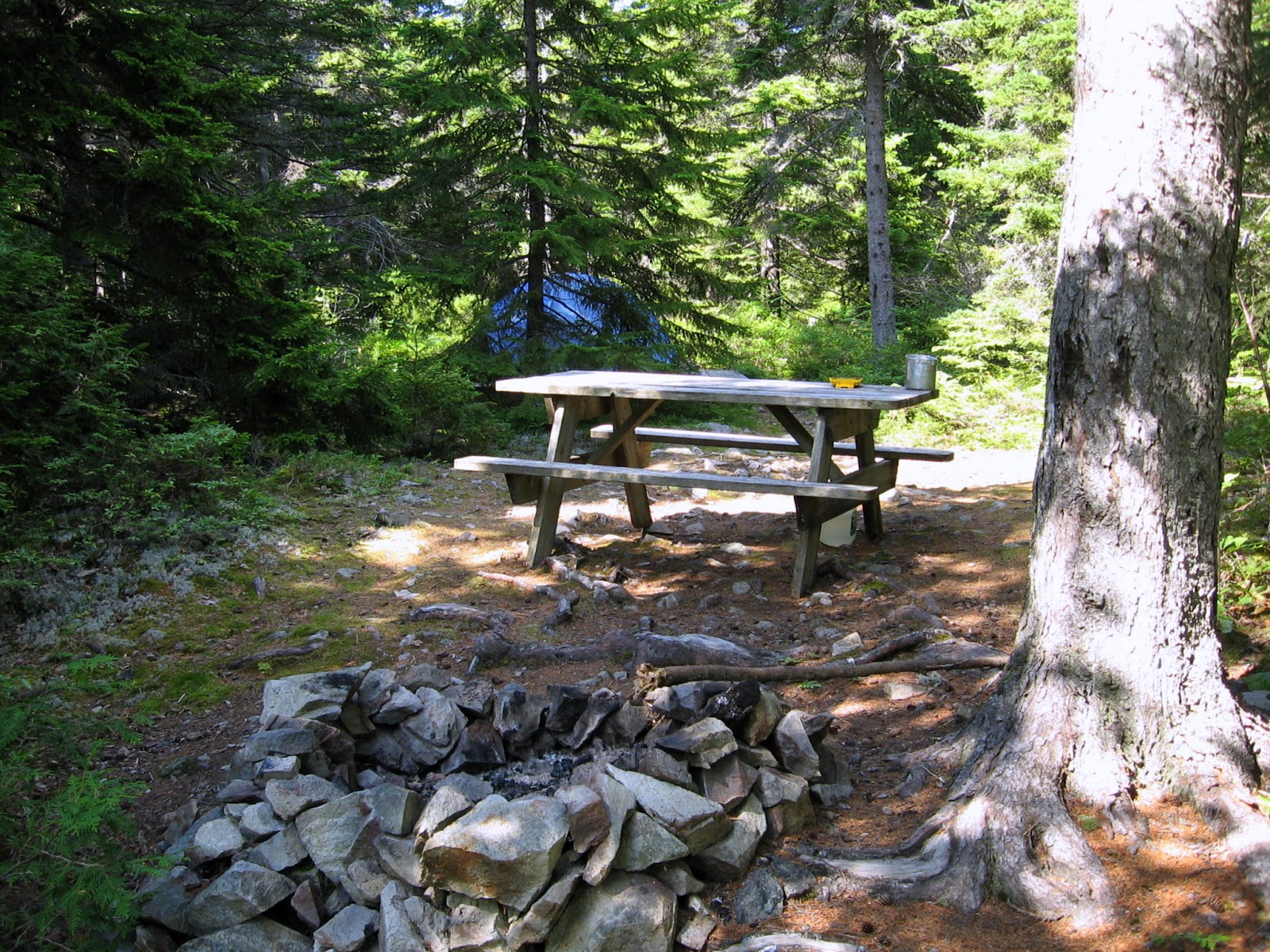
As it turned out with a week of gorgeous weather, hot and dry with very little wind to speak of, any side could have been considered the Quietside.  We arrive on the Monday after lunch and get set up in our campground; I'm using my tent, my friend has an electric/water site as she has a trailer.  I'm very happy with my site, lots of privacy with a tent platform set apart from the picnic table and fire pit.   My parking is very convenient too so I can haul gear in and out as it is needed.


Campsite

With everything shipshape we are ready for our first paddle, a short one but it is too nice an afternoon to waste sitting around.  So we head out to Manset town pier to launch.   Leaving Manset we travel east towards Sutton Island before turning northwest back towards the entrance to Somes Sound, rounding the northern tip of Greening Island thence southward to return to Manset pier.


off Manset town pier


Acadia Park Mt. Desert Island


Greening Island home

With our first paddle complete it is time for a much needed shower and change of clothes; wearing a wet suit in these temperatures one feels pretty cooked but water temperature averages 59 degrees which is pretty cool if you get dumped. Then it is off to have dinner at a restaurant in Bass Harbor which was highly recommended to us.  Excellent seafood!

Sunset from Bass Harbor restaurant

Paddle Day 1
Continue to Day 2