Showing posts with label Kayak camping. Show all posts

Monday, 26 June 2023

Camelot Island Kayak Camping

 Camelot Island

1000 Islands Kayak Camping

Note: click on images to see larger.

June 21 - June 23

My friend Pat and I decided a good way to celebrate my birthday was to do a two night camping trip to my favourite campsite of the 1000 Islands, namely site 1 on Camelot Island.   So we meet at Clark's Marina in Willowdale about 2 km west of Gananoque off Hwy 2.   I have used this marina many times over the years as a good place to leave our vehicles, parking is reasonable.  We unload the kayaks and set them at the outer edges of the ramp so hopefully not interfering with any power boat launches and begin the loading of gear.

Boat loading at ramp

 Boats loaded and our cars parked in the transient parking area we set off to follow the channel from Clark's down to the Bateau Channel which will lead us out to the Admiralty Island group SW of Gananoque.  Weather is hot with almost no wind so flat calm.   Before exiting the Bateau channel you cross the path of the Howe Island ferry which this day seemed quite busy.  After passing the ferry you are in the Admiralty Islands and we swing by Beau-Rivage a park island then the south tip of Lindsay island then around the north tip of Bostwick island home to Half Moon Bay where church services are held for island boaters.  Somewhere around here we pass a tour boat from Kingston in the design of a paddle steamer which is fake.

Kingston tour boat

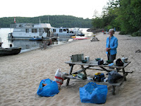
From here we aim for Huckleberry Island then set our sights on the Navigation light at Barge island at which point we can see Camelot to the ENE of us at approx 1.25 kms distance.   On arrival at Camelot we pull the yaks ashore and begin the unloading then hauling the gear uphill to site 1 where we set up the tents and get our bedding organised.  I have a cot (Helinox Cot 1) which has made all the difference to the quality of sleep I get, in fact I think if I didn't have it I probably wouldn't be camping as I had found just sleeping on an air mat was way too uncomfortable and gave me a sore back.  Our camp set-up can be seen below.

Kayak landing at Camelot


Camp set-up site 1


First thing we do after set-up is have our lunch as we had been running a bit late we opted to wait until arriving on site before having lunch.  Then we purchase a bag of firewood and pay for 2 days of beaching permits which is over and above the cost of site rental.  Beaching permits allow you access to any of the park islands and is paid for on site.    No more paddling for today so we spend some time gathering twigs and prepping the fire for this evening and then it is time to make dinner, my responsibility for the first night and it is my old staple spaghetti with meat sauce and a ceasar side salad.  After dinner we light our campfire and sit around and just enjoy the evening.

Campfire


Then it is off to bed after a very pleasant day.  Before retiring I dump a pot of water on the embers just to be on the safe side, we certainly don't need any more wildfires there has been quite enough of them around this year!

A little tardy getting up, 7:40 but what the heck it's my birthday I'm allowed to sleep in!   Another lovely day and I'm making today's breakfast; pancakes with bacon and syrup plus O.J. and coffee.   After breakfast we will head out for a paddle.   With breakfast over it is down to the landing to stow some gear in the yaks before heading off for today's paddle.  Just before we leave our camp we have some surprise visitors, a gaggle of Canada geese with this year's young have come up to wander around the grass looking for something to eat.

Today's visitor

We decide to head NE towards the Fleet Islands and along the way we spot yet another of the many Osprey nests to be seen in the 1000 islands.

Osprey nest


Today's paddle

Our course takes us NE following the line of the Fleet islands passing to the east of Prince Regent Island before turning left through the Gananoque Narrows to go NW towards Gordon island which is a park island so we can land there and have our lunch.   I have never camped on Gordon as I'm not crazy about the layout there and the kayak landing at the SW corner is pretty crappy, not great for unloading a kayak.  We paddle around and check it out but decide we will land at the main dock on the east side.   This is quite high and requires a bit of effort to climb up, I then use my bow rope to tether my yak to the bridge to shore so I can't be charged for mooring.

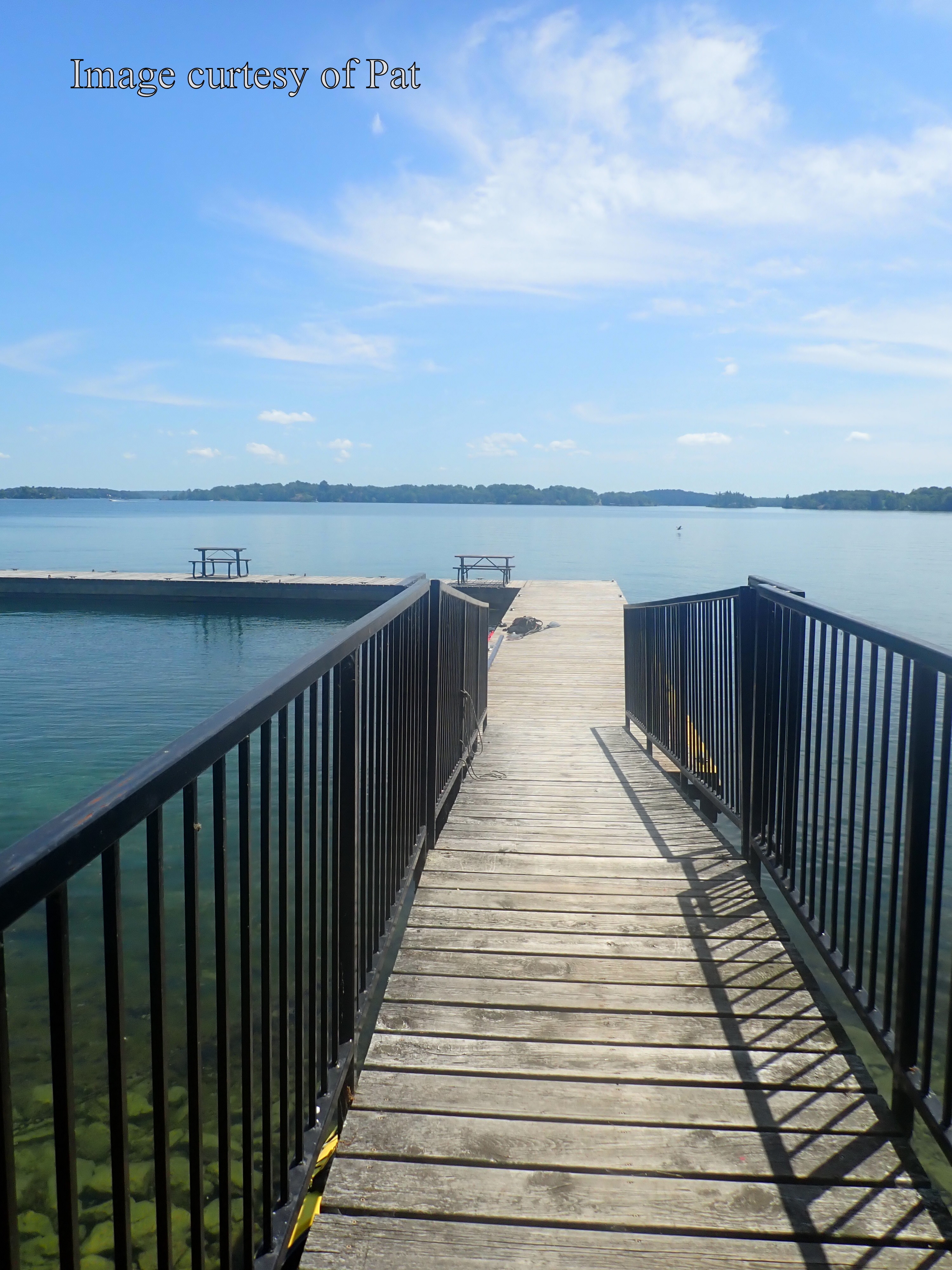
Gordon Is. dock


Having found a suitable picnic table we sit and have a relaxing lunch.  After awhile we hear a boat approach and it turns out to be the parks boat checking the faciities on the island.  Of course the ask if we have beaching permits and we explain we are camped at Camelot and purchased the permits there.  As they had already been to Camelot they would have found our payment in the box so no problem.   With lunch over we head back to Camelot aiming for Sugar island then turning SW but keeping to the opposite side of the islands we passed on our way up to Prince Regent.   Arriving back at camp we prep the fire for the evening and then generally laze around and read for the rest of our afternoon.   There are a fair number of insects to be found on these islands including wood roaches and millipedes that can usually be found under groundsheets and bags but today we see an interesting one making its way up a tree.   Turns out it is called an eastern eyed click beetle and is about 2 inches long, see below.

Eastern eyed click beetle

Now today is Pat's turn to make dinner and she is making me a pizza for my birthday.

Ta da!

Not only that but I get carrot cake with cream cheese icing for dessert complete with candle!

Birthday dessert

Just room for 1

Chef boyardee at work!

So all in all a pretty good way to celebrate a birthday and we enjoy the rest of our evening sitting around the fire.  Weather for tomorrow is supposed to be cloudy warm and humid but no precipation until evening so just fine for our paddle back to Clark marina.  Morning comes and it is not too bad at all, cloudy as forecast but nice and warm with almost no wind. On waking we both begin to break camp, I start with packing up what's inside, sleeping bag cot and clothing then move to dismantle tent. So Pat makes breakfast with her version of egg McMuffin, fried egg and bacon on a muffin, juice and some strawberry/rhubarb fruit dish all very tasty.  The site is supposed to be vacated by 11:00 and I know it is booked for the weekend so after our hearty breakfast we haul gear down to the landing to start packing the kayaks.

Packing up the kayak

By about 10:30 we are ready to roll and our heading will be SW just outside of American waters to begin with, passing Netley island then Deathdealer island and no it's not in the U.S. but who knows maybe they had some inflence on it's naming
😉.  We continue this heading to Jolly island where we do pass through some U.S. water but luckily no one shot at us!  At Jolly we turn right to aim for the top of Thwartway island (or Leek island) which is also a park island.

Pat in her Atlantic kayak

From the top of Thwartway if you look NW you can make out the sign for Half Moon Bay, a white crescent moon.  This is where a religous service is held for boaters/cottagers of the 1000 islands and has a pulpit and a wire around the inside of the cove where boaters can tether their boats while they listen to the sermon.  We use this landmark and head for it.

Heading to Half Moon Bay


Pat in Half Moon Bay

From here we retrace our course round tip of Bostwick island then skim past Beau-Rivage to head into the Bateau Channel and the turn off to Clark Marina and home.  Arriving at Clark we find a grassy area where we can drag out the yaks without using the main ramp as the owner was complaining about the time we spent on the ramp so this worked out fine.


Happy paddling!

from

KayakJock


Wednesday, 8 September 2021

Oiseau Rock revisited - Kayak camping on the Ottawa River

 Petawawa to Oiseau Rock

Note: click on an image to see larger

Oiseau Rock camping trip

September first and with a forecast for three days of sunny dry weather albeit likely rather windy days, we are at Petawawa ready to shove off for a couple of nights under the stars camping at Oiseau point beach on the Québec side of the Ottawa River.   After a rather long drive, almost 3 hours  I am loading up the kayak on the beach at Petawawa Point where there is adequate parking for us to leave our cars for the three days we will be gone.


Petawawa Point


Ready for anything?

As we head out the wind becomes very apparent and is likely around 20km from the NW so we decide to cut through the islands to use them as a bit of a windbreak as we travel upstream.    This part of the river is rife with shoals and with the chop it makes it more difficult to spot the rocks.   It is very slow going and after only about four and a half kilometers we seek shelter in a sandy cove to have some lunch but not before I almost got trapped on a shoal which the wind pushed me onto and I had great difficulty getting off.

Slow going

Lunch over we head back over to stay close to the islands trying to stay out of the wind and away from the Fort William shoreline where I know from past experience the shallows extend for some distance out into the river.   On a previous trip we ended up getting out of the boat and walking to deeper water!   After a rather tiring paddle we catch sight of our beach only to find we will not be alone as there is about four boats parked along the beach, hopefully we will not have any "party" boats to contend with.   On arrival we determine the east end of the beach will afford us the most privacy so we unload and get set up.


Our camp
Neighbours


After meeting with some of our neighbours our fears of party boats subside as this is an older crowd like us and content it seems to have some peace and quiet so all's good.     With the camp set up it is now time to start thinking of dinner as sunset is around 8 p.m. this time of year and we want to get all cleared up by then.   First though I prep the fire as Pat thoughtfully brought a bag of wood with her so I chop a bit of kindling and arrange on some paper I had brought.   I brought tonight's dinner, home made meatballs and Jasmine rice (curtesy of my wife) the meatballs were frozen and sealed in a plastic bag so can be heated in boiling water as can the rice which is precooked and sealed in plastic.  This was followed by some chocolate custard with fresh strawberries brought by Pat.    So after a satisfactory meal and a cup of coffee it is time to light the fire and relax till bedtime.

End of day 1

Neither of us appear in any rush to get up but by around 9 a.m. we are getting breakfast ready.  My call on this as I am making sausages with pancakes and the sausages will have thawed so best used first.  I check weather on my VHF and again wind from NW twenty gusting to forty so we will eschew paddling today and instead hike to the top of the rock.

Check the weather

One thing that's great about our camp is we are in a bay completely sheltered by the mass of Oiseau Point at our back but looking past the point to the main stream of the river the white caps are very evident.  I am aware there is a picnic table by the shore of the small tarn atop the rock so we will bring our lunches to eat after our strenuous hike which is around 40 minutes or so.

Are we there yet?
Hurry up!


Then one reaches the top and takes in the beautiful panorama that awaits and all that effort is suddenly so worthwhile.

Ottawa River from Oiseau Rock lookout


Oiseau Point

After admiring the view we retire to the picnic table by the tarn to have our lunch and relax for a bit before making our descent.

Lunch by the tarn

Suitably fortified we begin our descent which is every bit as tricky as coming up, at least the ground is dry although loose soil can make things slippery.   There is a knotted rope strung down the steepest part so you have something to hold onto.


Rope-a-dope?

Having made it safely back to camp we decide to take a walk on more even terrain following the shoreline southwards for as far as we can which is just over half a kilometer until you reach an impasse or have to swim for it.   In the image below taken on our walk you can see the beach with our camp at far right and the house boats parked to our left.

Oiseau Beach camp

Pat's turn to supply dinner tonight and she has a special treat, pizza; something I didn't think was possible when camping.   So while she cuts up the toppings I prep the fire for later. This pizza is done using a bake oven, a sort of frying pad with lid which goes on the camp stove then gets covered with a fireproof mantle to help keep in the heat, see below.


After
Before


Bake oven

Very tasty indeed!  The same device gets used next morning when Pat makes a frittata with sausage, feta, potato and eggs.  So another evening is spent round the fire gazing at the stars and then off to bed.

Close of day two

Our last day and we are up at seven to start breaking camp and packing up the gear before having breakfast.  The wind is less today but still NW gusting to 13 km but will be less of a problem being on our starboard quarter as we travel downstream.  When we are ready to leave we decide to paddle round the point and upstream a little to get a good view of the rock from the water.  I am gratified to see that there appears to be less graffiti than last time I visited, I'm guessing an attempt was made to remove some of it.

Oiseau Rock


Of course the world is not about to run out of morons any time soon so despite the new plaque describing the rocks heritage and making a plea to not despoil this archeological site there is still no shortage of graffiti some of which is quite recent as the perpetrators often date their inane scribbles.

Graffiti


Leaving the rock behind we head downstream towards Petawawa and ultimately home.  About 3 km downstream we round the bend where the lighthouse is, and now for at least 3 km we will be in the lee of the shore so calmer waters prevail until we pass Chalk Bay a large inlet to the NW where the wind will have a good fetch once again.  The scenery here is quite magnificent.

Heading downstream

Passing Chalk Bay we are back in the wind so now once again we will try to island hop keeping the islands to starboard to try and keep us out of the wind which is gusting quite strongly at times.

Getting a push from the wind

As we come to Oak Island there is a sheltered cove where we turn in to make a pitstop and have a snack.  From here it will be a bit over 6 km to Petawawa Point.

Snack time
Oak Island


As we get closer to Petawawa I try to remember where I found a channel closer to the Ontario side on a previous visit and we head for the first opening I see only to find when close enough there is a line of breaking water stretching across it and with the wind I'll not risk getting swept on to another shoal.  So turning left we look for another and spot a channel marker where we make a right and can  now see we have a clear path to Petawawa Point.    After packing up all the gear and tying down the kayaks we drive over to the nearest McDonalds to get some cold drinks before beginning the long drive (for me) home.  This brings to an end  what was a rather pleasant three day camping trip, the wind was tedious on the outbound leg but no bother at the camp and finally I get a camping trip without a torrential downpour, like my last two this year.


Happy Kayaking!

from

KayakJock

Saturday, 18 August 2018

Lyndhurst to Gananoque kayak camping

Day 1

Lyndhurst to Camp Roy

Lyndhurst-Camp Roy
21 km

Today August 14, I am finally getting around to enacting a short camping trip I first envisioned back in 2013 which is when a friend and I first ventured down the Gananoque River.   At one time this waterway would have allowed almost uninterrupted canoe travel between Morton on the Rideau and Gananoque on the St. Lawrence river and would have been a convenient canoe route for our First Nations people but now one has to contend with a number of dams.  In 2013 my friend and I paddled from Lyndhurst to the first of these dams at Marble Rock a distance of 30 km, at which point we walked the portage and took out.    On that paddle I was scouting the river for possible campsites so that on a future occasion I might return and do an overnight camp and complete the 40 plus kilometres to Gananoque.   I did find a suitable camp and that is our destination today.  Earl, my paddling companion today meets at my home where his gear gets transferred to my vehicle and once again my wife gets pressed into taxi driver service to ferry us to the put-in at Lyndhurst.


Lyndhurst put-in

The day is hot and humid, overcast and threatening rain which before long materialises in the form of off and on drizzle.  Starting across Lyndhurst lake we enter Lyndhurst creek which after a couple of kilometres will change to Singleton lake.  This area is very pretty in the fall of the year.


Lyndhurst Creek
Singleton Lake


Following the NE shore we are soon back in the creek for about a kilometre before turning into the longish SW arm of Redhorse lake which we follow until it opens out into the main body of the lake and here we will stop for lunch at Squaw island which I know has a picnic table and would also make a nice campsite but we have only travelled a bit over 9 km and we need to get half way before camping.

Squaw island
Lunch stop on Squaw Is.
We get through lunch without rain and the sun tries to shine off and on so not too bad a day so far.  Lunch over we round the bend and almost reverse our course from NE to SSW as we paddle down Redhorse towards Black Rapids.  At Black Rapids there is a bridge for County road 3 to paddle under and then about another 3 km to start of Gananoque Lake.

Black Rapids
Co road 3 bridge

This is a pleasant area to paddle, boat traffic is almost non-existent and cottages few with scenery that varies from rugged to marshy wetlands and some of it protected under the Frontenac Arch Biosphere.   Plenty of Osprey, Kingfishers, Great Blue Herons and a few Green Herons are to be seen along the way.


Lower Redhorse Lake

Around 3:30 we arrive at our camp which I have named Camp Roy as there is a commemorative plaque on a rock honoring one Roy Griffin (?) I think; so I say thanks to Roy for this legacy which we now enjoy.

Camp Roy


My tent
Campsite


Yours truly!

After we get set up the rain finally tapers off and we enjoy dinner and a peaceful evening which ended with a bit of a sunset so tomorrow may be better.

Sunset from Camp Roy

Day 2

Camp Roy to Marble Rock

Camp Roy to Marble Rock
10 km
Our second day and the weather is nicer in that the sun is shining and no sign of rain although with the heavy humidity we can expect a thunderstorm before the day is over.   I break camp and pack before breakfast just in case, then after a leisurely breakfast we are setting off around 10 a.m.   We have around 10 km to travel before reaching the portage at Marble Rock, so likely lunch time.   We noticed that there is another campsite about 100m across this little bay and we paddle over for a look before leaving.   It is a lot less roomy and landing the yaks would be more chalenging but if you were stuck it could do.  So the upper reaches of Gananoque lake stretch ahead.


Gananoque Lake
There is a small cottage community in the NE corner called Sand Bay and a lodge at the bottom SW where it narrows to a river again.   A little way down this river the habitat changes to marshy wetlands and Wiltse creek which connects to Charleston Lake, joins the river on the east side although this is not easily discerned due to the extensive weeds.  

Marshy wetlands

Beyond the wetlands the river gradually narrows as we approach the dam at Marble Rock where we will portage 215m and stop for lunch and likely a much needed rest!  A family of Mute swans paddle off out of harms way.

Mute swans

photo credit "Earl"
Before doing the portage we paddle round and take a quick look at the dam, but now for the hard part, beach and unload the gear then haul everything up a slope (I brought a set of wheels); luckily some kind soul has done some bush-whacking and the trail is much easier to traverse than it was about a month ago when I checked it out.  Earl eschews the wheels (his yak is kevlar) and opts to shoulder his out.


Take-out for portage

Portage

The take-out looks daunting from the water but the trail goes around the right side of the rock pile at a more gradual slope.

Earl's gear photo by Earl

"Almost there"  photo by Earl

At the end of the trail there is a short carry down to the gravel beach where we load up then get the chairs out for a rest and some lunch before continuing our paddle to Gananoque.


End of the trail
Ready to roll

Day 2

Marble Rock to Gananoque

Marble Rock to Gananoque
11 km
The river meanders along and is a bit weedy this time of year, very peaceful with an occasional cottage or farm.  A gaggle of domestic geese seem to find us of particular interest (not much happens in these parts!).   Humidity is high and some ominous looking clouds forming and occasional thunder but hopefully we can get finished before it breaks.


Domestic geese

Nothing much until the hamlet of Maple Grove where you pass under the  road bridge for county rd 32 and a short way after that it is Via Rail which runs Brockville to Kingston.

Co rd 32


Before long we can hear the traffic on hwy 401 but also thunder with increasing frequency spurring us on, hoping we can get off the water before the rain starts.  My plan was to take out at a spot just north of the Kinsman daycare off Stone St. but just as we reach it the rain is starting and the wind is picking up.


planned take-out

So I suggest we try the canoe club where they have docks and ask them if we can unload there.  It is about 400m ahead and just 300m short of the dam which is as far as you can go on the river.   It pours rain, wind, thunder and lightning as we scramble to get gear off and under a tree.  The kids have all run for cover but we get the okay from one of their minders, we are wet but happy that it waited until we were done as it could have been problematic if it had come when we were making or breaking camp or worse during the portage.

Canoe club docks credit Earl
Then I have to walk a block north to meet my wife who will be at the Kinsman take-out by now awaiting our arrival, then it is load up and head for home.


Happy paddling!


KayakJock