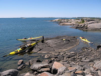
This past August I was once again fortunate to spend a few days with friends paddling and camping in the area known as the Thirty Thousand Islands of Georgian Bay, my third visit to this beautiful rugged wilderness area.
The plan was to begin our trip from Snug Harbour then NW along the western side of Franklin Island and work our way up to Big McCoy with a one or two night camp to allow exploration of the McCoys and perhaps the Limestone's further west before heading southward to Green Island to camp, thence through the Minks and back east completing the loop back towards Snug Harbour. Well as you can see from the map
below it didn't quite work out that way, weather dictated otherwise.
Green=D1 Yellow=D2 Blue=D3 Red=D4 Purple=D5
heading west toward Franklin Is.
The weather driving up to Parry Sound was grey and rainy but as we approached Parry Sound it dried up and the sun came out which seemed to augur well for our trip. As it was late afternoon by the time we launched we planned to look for a camp somewhere close by, around Henrietta Point at the SW corner of Franklin Island where there are several suitable sites. We eventually decided on Lenice Island which is a little north of there on the west side of Franklin Is. A nice site with sheltered landing and the convenience of a thunderbox.
Lenice Is.
Day two dawns bright and sunny and we continue northwest passing Oak Island then stopping at an unnamed island for lunch before making the 3km crossing to Big McCoy where we plan to camp perhaps for two nights.
Day 2
 |
| Stark beauty |


In rock or in the water
Big McCoy offers many campsites and we settled on one at the southern extremity which provided easy landing for our kayaks and where previous visitors had left several flat rocks set up that could be used as tables. It also had that important amenity, the thunderbox! Behind where we set up, in the trees was a large flat clearing that we think may have been used for meetings by native peoples.
Kitchen area
Parking on Big McCoy
We had hoped to stay here two nights to allow exploration of The Limestone Islands about 5km to the west but weather forecast was predicting high winds beginning NW then changing to W so rather than risk being wind bound here we determined to head back towards north end of Franklin to find a sheltered camp that we could easily gain access to the Shebeshekong channel east of Franklin and so have sheltered passage back to Snug Harbour if winds stayed strong. Our day on Big McCoy ended gloriously with a beautiful sunset which we sat and watched from a westerly facing rocky shore.
Sunset from Big McCoy
With high wind warnings forecast we felt it prudent to move on after only a one night stay on Big McCoy heading back to the north end of Franklin Island to look for another camp that would allow easy access to the inside channel between Franklin and the mainland and so be sheltered from the predicted west winds when paddling back to Snug Harbour. After first stopping and checking out a site on King Island where we had lunch, we carried on to another site on a beach at the NE of Franklin Island. This was a nice sheltered site although a little too close to civilization for my liking, cottages could be seen on the opposite shore. This site had a sandy beach, a bit of a rarity in this area as well as a picnic table and yet another thunderbox. The wind could be heard high in the trees overnight but as we were in the lee of the island waters stayed calm.
The next day we toured around some of the islands staying to leeward so that we never had to deal with the brunt of the wind and waves coming from the west. Checked some other campsites around where we stopped for lunch, found that some were now inaccessible from the water as channel entrance was too shallow requiring us to walk in from an adjacent channel. Apparently water levels have been steadily dropping. Once again we were rewarded with a beautiful sunset to end our fourth day of the trip.
Day five dawned overcast, blustery and with the rumble of thunder in the distance so we hurried to break camp as possible thunderstorms and rain were forecast. A light shower began before we finished packing up but not enough to be of any concern and we set off on our final leg of the trip heading east then southeast into the shelter of the Shebeshekong channel enroute to Snug Harbour.
Author, image courtesy of Karl Parks
The thunderstorm never materialized and the trip down Shebeshekong channel was uneventful until we reached Burritt Point where we turned west exiting the channel only to encounter strong westerly winds and high waves making a real struggle out of the last two kilometres before finally surfing east into Snug Harbour. A great trip even if we didn't make it to all of our planned destinations but good reason to go back again in the future.
KayakJock
All images by author unless otherwise noted.
All images by author unless otherwise noted.


Hi,
ReplyDeleteWill you please post a link to your Blog at The Kayaking Community? Our members will appreciate it.
Members include: Kayakers, Kayaking Experts, Guides, Clubs, Groups, Etc.
It's easy to do, just cut and paste the link and it automatically links back to your website. You can also add Articles, Photos, Videos and Classifieds if you like.
Email me if you need any help or would like me to do it for you.
Please feel free to share as often and as much as you like.
The Kayaking Community: http://www.vorts.com/kayaking/
I hope you consider sharing with us.
Thank you,
James Kaufman, Editor